St. Frances de Chantal's Church, New York City
Map
Facts and practical information
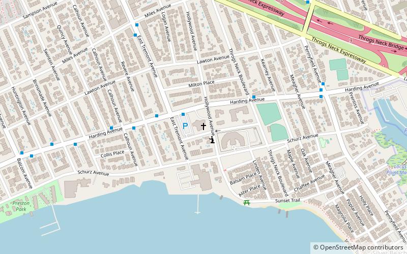
The Church of St. Frances de Chantal is a Roman Catholic parish church under the authority of the Roman Catholic Archdiocese of New York, located at Harding Avenue at Throggs Neck Blvd. Bronx, New York City. The parish was established in 1927. ()
Coordinates: 40°48'57"N, 73°48'51"W
Address
190 Hollywood AvenueEast Bronx (Throgs Neck)New York City
ContactAdd
Social media
Add
Getting there by public transportation
Public transportation stops near this location
- Bus
 Bus
Bus
- Calculate routeSUNY Maritime Circle & Shepard Avenue 21 min walk
- Calculate routeRandall Avenue & East Tremont Avenue 22 min walk
Maps SubwayMaps
 Manhattan Buses
SubwayMapsManhattan BusesDay trips


Frequently Asked Questions (FAQ)
How to get to St. Frances de Chantal's Church by public transport?
The nearest stations to St. Frances de Chantal's Church:
Bus
Bus
- SUNY Maritime Circle & Shepard Avenue • Lines: Bx40 (21 min walk)
- Randall Avenue & East Tremont Avenue • Lines: Bx42 (22 min walk)