Hotel Row, Atlanta
Facts and practical information
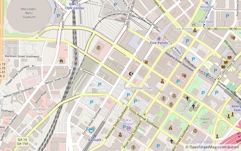
Hotel Row is a both National Register and locally listed historic district consisting of one block of early 20th-century commercial buildings, three to four stories high, located on Mitchell Street west of Forsyth Street in the South Downtown district of Atlanta. The buildings were originally hotels with ground level retail shops built to serve the needs of passengers from Terminal Station, opened in 1905. The buildings are the most intact row of early 20th-century commercial structures in Atlanta's original business district. The decline of Hotel Row began in the 1920s due to the increased availability of automobile transportation and the construction of the Spring Street viaduct, which made getting to hotels in the northern part of the city easier. In the 1950s and 1960s, the increase in air travel led ultimately to the demolition of Terminal Station in 1971. ()
Downtown Atlanta (South Downtown)Atlanta
- Metro
- Bus
- Tram
 Metro
Metro
- Calculate routeFive Points 6 min walk
- Calculate routeGarnett 8 min walk
- Calculate routeGWCC/CNN Center 10 min walk
- Calculate routeGeorgia State 13 min walk
- Calculate routeAtlanta Greyhound Bus Station 7 min walk
- Calculate routeWest End Station 40 min walk
- Calculate routePark Place 11 min walk
- Calculate routeWoodruff Park 12 min walk
- Calculate routeLuckie at Cone 13 min walk
- Calculate routeHurt Park 14 min walk
Hotel Row – popular in the area (distance from the attraction)
Nearby attractions include: Philips Arena, M. Rich Building, Tabernacle Concert Hall, Mercedes-Benz Stadium.


Frequently Asked Questions (FAQ)
Which popular attractions are close to Hotel Row?
How to get to Hotel Row by public transport?
Metro
- Five Points • Lines: Blue, Gold, Green, Red (6 min walk)
- Garnett • Lines: Gold, Red (8 min walk)
Bus
- Atlanta Greyhound Bus Station (7 min walk)
- West End Station • Lines: 832 (40 min walk)
Tram
- Park Place • Lines: Atlanta Streetcar (11 min walk)
- Woodruff Park • Lines: Atlanta Streetcar (12 min walk)