San Francisco South of Market Leather History Alley, San Francisco

Gallery (1)
Map
Map
Facts and practical information
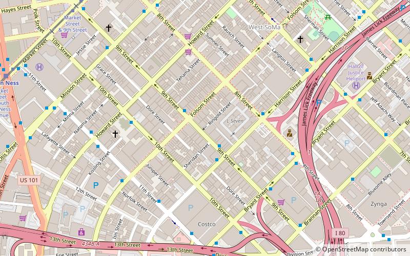
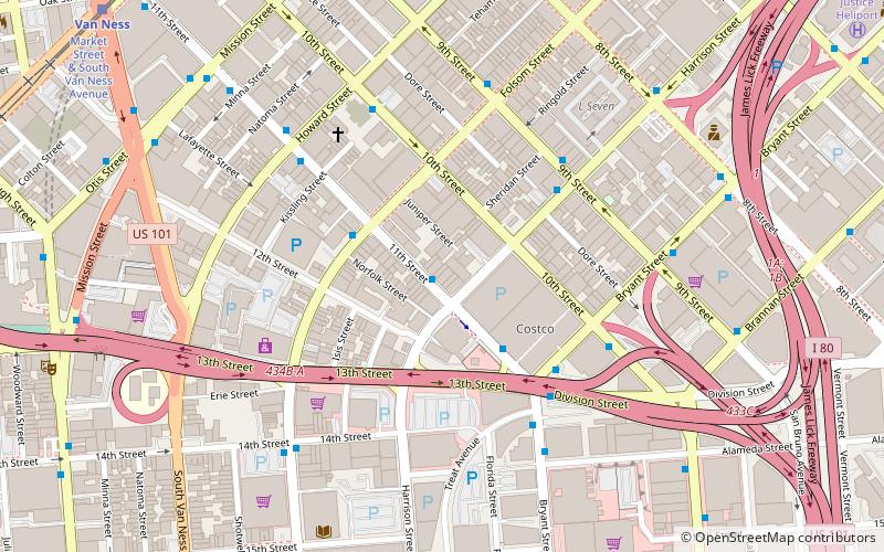
The San Francisco South of Market Leather History Alley consists of four works of art along the Ringold Street alley in San Francisco's SOMA district honoring leather culture; it opened in 2017. ()
Coordinates: 37°46'24"N, 122°24'39"W
Address
Southeast San Francisco (South of Market)San Francisco
ContactAdd
Social media
Add
Getting there by public transportation
Public transportation stops near this location
- Metro
- Bus
- Trolleybus
- Tram
- Light rail
- Train
 Metro
Metro
- Calculate route9th Street & Harrison Street 2 min walk
- Calculate routeHarrison Street & 9th Street 3 min walk
- Calculate route10th Street & Howard Street 5 min walk
- Calculate routeMission Street & 9th Street 8 min walk
- Calculate routeMarket Street & 9th Street 11 min walk
- Calculate routeCivic Center 12 min walk
- Calculate routeVan Ness 12 min walk
- Calculate routePowell Street 20 min walk
- Calculate routeKing Street & 4th Street 23 min walk
- Calculate routeCivic Center 12 min walk
- Calculate route16th Street Mission 19 min walk
- Calculate routeSan Francisco 4th & King Street 23 min walk
- Calculate route22nd Street 39 min walk
Maps Muni Metro
Muni MetroDay trips


Frequently Asked Questions (FAQ)
Which popular attractions are close to San Francisco South of Market Leather History Alley?
Nearby attractions include New Langton Arts, San Francisco (2 min walk), Leather and LGBTQ Cultural District, San Francisco (3 min walk), St. Joseph's Church and Complex, San Francisco (3 min walk), Prelinger Library, San Francisco (4 min walk).
How to get to San Francisco South of Market Leather History Alley by public transport?
The nearest stations to San Francisco South of Market Leather History Alley:
Bus
Trolleybus
Tram
Light rail
Metro
Train
Bus
- 9th Street & Harrison Street • Lines: 292, 397, 398 (2 min walk)
- Harrison Street & 9th Street • Lines: 27 (3 min walk)
Trolleybus
- Mission Street & 9th Street • Lines: 14 (8 min walk)
Tram
- Market Street & 9th Street • Lines: F (11 min walk)
Light rail
- Civic Center • Lines: K, N, S, T (12 min walk)
- Van Ness • Lines: K, N, S, T (12 min walk)
Metro
- Civic Center • Lines: Blue, Green, Red, Yellow (12 min walk)
- 16th Street Mission • Lines: Blue, Green, Red, Yellow (19 min walk)
Train
- San Francisco 4th & King Street (23 min walk)
- 22nd Street (39 min walk)