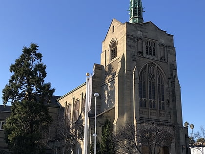
Longfellow, Oakland
Map

Gallery

Facts and practical information
Longfellow is a neighborhood of North Oakland, California. It is bounded by Temescal Creek to the north, State Route 24 to the east, Interstate 580 to the south, and Adeline Street to the west. ()
Coordinates: 37°49'59"N, 122°16'19"W
Address
North Oakland (Longfellow)Oakland
ContactAdd
Social media
Add
Day trips
Longfellow – popular in the area (distance from the attraction)
Nearby attractions include: Piedmont Avenue, Oaks Park Stadium, The Museum of Art and Digital Entertainment, Bay Street Emeryville.
Frequently Asked Questions (FAQ)
Which popular attractions are close to Longfellow?
Nearby attractions include North Oakland, Oakland (8 min walk), Emeryville, Oakland (19 min walk), Temescal, Oakland (20 min walk), San Pablo Arts District, Oakland (21 min walk).
How to get to Longfellow by public transport?
The nearest stations to Longfellow:
Bus
Metro
Train
Bus
- Market Street & 43rd Street • Lines: 88, F (2 min walk)
Metro
- MacArthur • Lines: Orange, Red, Yellow (11 min walk)
- Rockridge • Lines: Yellow (36 min walk)
Train
- Emeryville (31 min walk)


