Alewife Brook Parkway, Belmont
Map
Facts and practical information
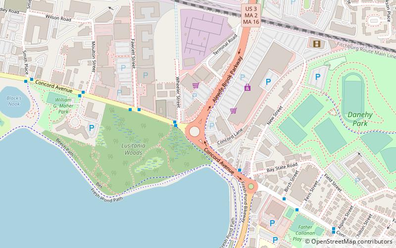
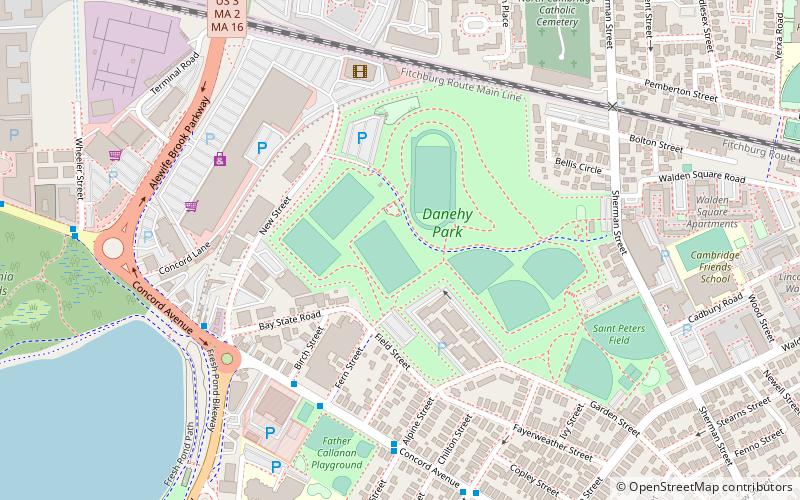
Alewife Brook Parkway is a short parkway in Cambridge and Somerville, Massachusetts. It is listed on the National Register of Historic Places. It begins at Fresh Pond in Cambridge, and heads north on the east bank of Alewife Brook, crossing into West Somerville and ending at the Mystic River on the Medford town line, where it becomes Mystic Valley Parkway. The entire length of Alewife Brook Parkway is designated as part of Massachusetts Route 16, while the southernmost sections are also designated as part of Route 2 and U.S. Route 3. It is managed by the Department of Conservation and Recreation with the Massachusetts Department of Transportation responsible for bridge maintenance. ()
Coordinates: 42°23'19"N, 71°8'36"W
Address
Cambridge (Cambridge Highlands)Belmont
ContactAdd
Social media
Add
Getting there by public transportation
Public transportation stops near this location
- Metro
- Bus
 Metro
Metro
- Calculate routeAlewife 13 min walk
- Calculate routeAlewife 14 min walk
- Calculate routeDavis 31 min walk
Day trips


Frequently Asked Questions (FAQ)
Which popular attractions are close to Alewife Brook Parkway?
Nearby attractions include Mayor Danehy Park, Belmont (8 min walk), Fresh Pond Parkway, Belmont (10 min walk), Cambridge Highlands, Belmont (11 min walk), Rindge Towers, Arlington (11 min walk).
How to get to Alewife Brook Parkway by public transport?
The nearest stations to Alewife Brook Parkway:
Bus
Metro
Bus
- Alewife (13 min walk)
Metro
- Alewife • Lines: Red (14 min walk)
- Davis • Lines: Red (31 min walk)