Walnut Hill, Omaha
Map
Facts and practical information
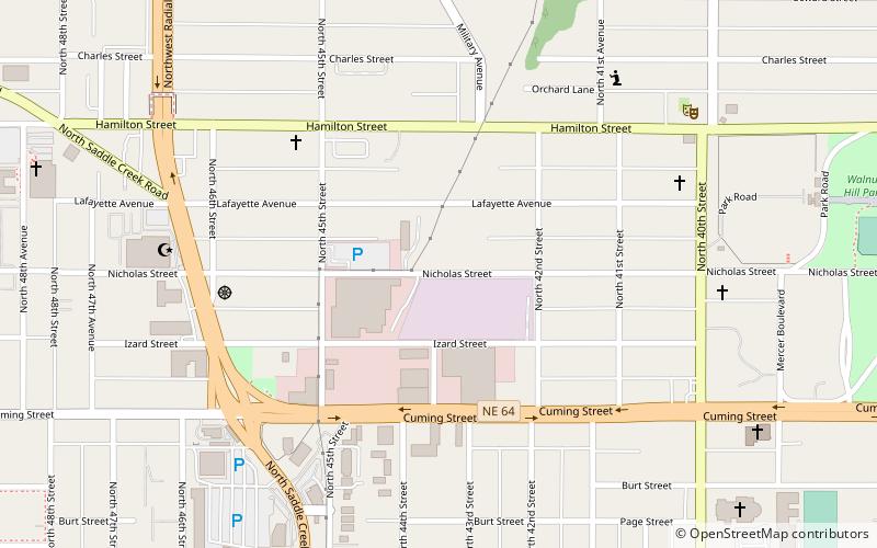
Walnut Hill is a historic neighborhood located in north Omaha, Nebraska. It is bounded by North 40th Street on the east, Cuming Street on the south, Northwest Radial Highway and Saddle Creek Road on the west and Hamilton Street on the north. ()
Coordinates: 41°16'12"N, 95°58'41"W
Address
Midtown (Walnut Hill)Omaha
ContactAdd
Social media
Add
Getting there by public transportation
Public transportation stops near this location
- Bus
 Bus
Bus
- Calculate route50th & Dodge 25 min walk
- Calculate routePark Avenue & Douglas 36 min walk
Day trips


Frequently Asked Questions (FAQ)
Which popular attractions are close to Walnut Hill?
Nearby attractions include Lowe Avenue Presbyterian Church Omaha, Omaha (8 min walk), St. Cecilia Cathedral, Omaha (10 min walk), Orchard Hill, Omaha (11 min walk), City Sprouts, Omaha (11 min walk).
How to get to Walnut Hill by public transport?
The nearest stations to Walnut Hill:
Bus
Bus
- 50th & Dodge • Lines: 2 (25 min walk)
- Park Avenue & Douglas • Lines: 2 (36 min walk)