Houston Fire Station No. 7, Houston

Gallery (1)
Map
Map
Facts and practical information
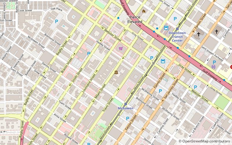
Houston Fire Station No. 7 is a historic fire station located at 2403 Milam Street in Houston, Texas. It was listed on the National Register of Historic Places on April 17, 1986. The fire station was built in 1898 and opened the next year as the first paid station in Houston. It was active until a replacement was built 1969. The building has been used as the Houston Fire Museum after a renovation, started in 1980. ()
Coordinates: 29°44'51"N, 95°22'29"W
Address
South Central Houston (Midtown)Houston
ContactAdd
Social media
Add
Getting there by public transportation
Public transportation stops near this location
- Bus
- Light rail
 Bus
Bus
- Calculate routeMcGowen 4 min walk
- Calculate routeDowntown Transit Center 9 min walk
- Calculate routeBell 15 min walk
- Calculate routeEnsemble/HCC 16 min walk
- Calculate routeGreyhound Bus Lines 6 min walk
- Calculate routeFlixBus Houston 7 min walk
- Calculate routeDowntown Transit Center 8 min walk
- Calculate routeWheeler Station Transit Center 29 min walk
Day trips


Frequently Asked Questions (FAQ)
Which popular attractions are close to Houston Fire Station No. 7?
Nearby attractions include Houston Fire Museum, Houston (1 min walk), Bagby Park, Houston (8 min walk), Houston tunnel system, Houston (9 min walk), Cullen Center, Houston (11 min walk).
How to get to Houston Fire Station No. 7 by public transport?
The nearest stations to Houston Fire Station No. 7:
Light rail
Bus
Light rail
- McGowen • Lines: Red (4 min walk)
- Downtown Transit Center • Lines: Red (9 min walk)
Bus
- Greyhound Bus Lines (6 min walk)
- FlixBus Houston • Lines: 2210, 2211, 2240, 2271 (7 min walk)