Milthorpe, Sydney
Map
Facts and practical information
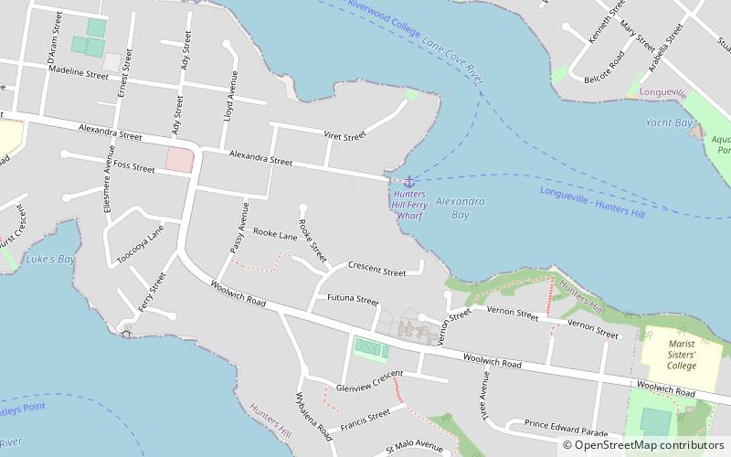
Milthorpe is a heritage-listed residence located at 12 Crescent Street, Hunters Hill in the Municipality of Hunter's Hill local government area of New South Wales, Australia. It was built during 1872 by Richard Sim. It is also known as Atherslei. It was added to the New South Wales State Heritage Register on 2 April 1999. ()
Coordinates: 33°50'12"S, 151°9'36"E
Address
Hunter's HillSydney
ContactAdd
Social media
Add
Getting there by public transportation
Public transportation stops near this location
- Bus
- Ferry
 Bus
Bus
- Calculate routeHunters Hill Ferry Wharf 3 min walk
- Calculate routeRiverview College Wharf 14 min walk
- Calculate routeLongueville Wharf 14 min walk
- Calculate routeDrummoyne Ferry Wharf 16 min walk
- Calculate routeDrummoyne - Lyons Rd 27 min walk
- Calculate routeRiverview Terminus 30 min walk
Maps Sydney TrainsMaps
 Sydney Light RailMaps
 Sydney Ferries
Sydney TrainsMapsSydney Light RailMapsSydney FerriesDay trips


Frequently Asked Questions (FAQ)
Which popular attractions are close to Milthorpe?
Nearby attractions include The Chalet, Sydney (9 min walk), Kellys Bush Park, Sydney (13 min walk), Gladesville Bridge, Sydney (20 min walk), Tarban Creek Bridge, Sydney (23 min walk).
How to get to Milthorpe by public transport?
The nearest stations to Milthorpe:
Ferry
Bus
Ferry
- Hunters Hill Ferry Wharf (3 min walk)
- Riverview College Wharf (14 min walk)
Bus
- Drummoyne - Lyons Rd • Lines: M52 (27 min walk)
- Riverview Terminus (30 min walk)