Book City, Toronto
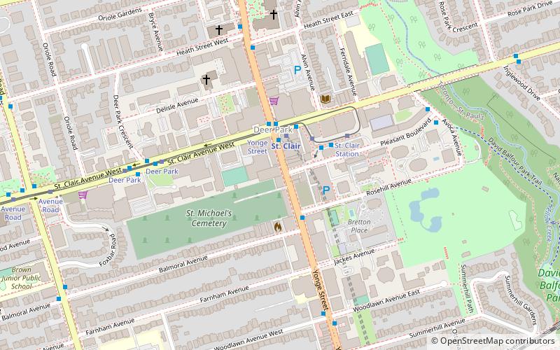
Map
Facts and practical information
Book City is a Canadian independent book store chain based out of Toronto. ()
Coordinates: 43°41'13"N, 79°23'38"W
Address
1430 Yonge StreetMidtown (Deer Park)Toronto
Contact
+1 416-926-0749
Social media
Add
Getting there by public transportation
Public transportation stops near this location
- Metro
- Bus
- Tram
 Metro
Metro
- Calculate routeSt. Clair 2 min walk
- Calculate routeSummerhill 11 min walk
- Calculate routeDavisville 20 min walk
- Calculate routeRosedale 20 min walk
- Calculate routeYonge Street 2 min walk
- Calculate routeSt. Clair Station 3 min walk
- Calculate routeDeer Park 6 min walk
- Calculate routeAvenue Road 10 min walk
- Calculate routeSt. Clair 3 min walk
- Calculate routeLonsdale Road 13 min walk
- Calculate routeDavisville Station 20 min walk
- Calculate routeRosedale Station 20 min walk
Maps SubwayMaps
 Streetcar systemMaps
 PATH
PATH
SubwayMapsStreetcar systemMapsPATHDay trips


Frequently Asked Questions (FAQ)
Which popular attractions are close to Book City?
Nearby attractions include St. Michael's Cemetery, Toronto (4 min walk), Hollywood Theatre, Toronto (5 min walk), Calvin Presbyterian Church, Toronto (5 min walk), Christ Church Deer Park, Toronto (7 min walk).
How to get to Book City by public transport?
The nearest stations to Book City:
Metro
Tram
Bus
Metro
- St. Clair • Lines: 1 (2 min walk)
- Summerhill • Lines: 1 (11 min walk)
Tram
- Yonge Street • Lines: 512 (2 min walk)
- St. Clair Station • Lines: 512 (3 min walk)
Bus
- St. Clair (3 min walk)
- Lonsdale Road • Lines: 13A, 13B (13 min walk)