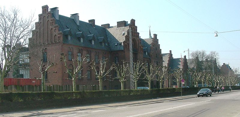
Peter Bangs Vej, Copenhagen
Map

Gallery

Facts and practical information
Peter Bangs Vej is a 2.2 km long street in Frederiksberg, a city in the Copenhagen area on the island of Zealand, Denmark. The direct continuation of Smallegade, it initially runs west, from Nordre Fasanvej, but then turns south along the east side of Damhus Lake to meet Roskildevej. There is a large sports complex on the south end of the street with the football club F.C. Copenhagen's training facilities as well as the multi-purpose venue K.B. Hallen. ()
Length: 9121 ftCoordinates: 55°40'44"N, 12°30'26"E
Day trips
Peter Bangs Vej – popular in the area (distance from the attraction)
Nearby attractions include: Copenhagen Zoo, Frederiksberg Gardens, Frederiksberg Palace, Spinderiet.
Frequently Asked Questions (FAQ)
Which popular attractions are close to Peter Bangs Vej?
Nearby attractions include Lindevangsparken, Copenhagen (6 min walk), Finsensvej, Copenhagen (6 min walk), Dalgas Boulevard, Copenhagen (10 min walk), Sønderjyllands Allé, Copenhagen (11 min walk).
How to get to Peter Bangs Vej by public transport?
The nearest stations to Peter Bangs Vej:
Bus
Light rail
Metro
Train
Bus
- Dalgas Boulevard • Lines: 9A (3 min walk)
- Peter Bangs Vej St. • Lines: 9A (3 min walk)
Light rail
- Peter Bangs Vej • Lines: C (4 min walk)
- Flintholm • Lines: C, F, H (15 min walk)
Metro
- Lindevang • Lines: M1, M2 (11 min walk)
- Flintholm • Lines: M1, M2 (15 min walk)
Train
- Valby (28 min walk)

 Metro
Metro


