Christmas Møllers Plads, Copenhagen
Map

Map

Facts and practical information
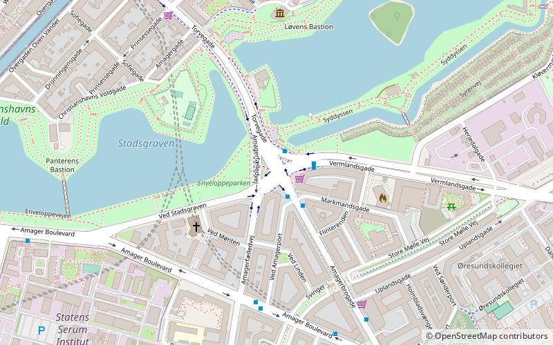
Christmas Møllers Plads is a major junction located in front of the embankment to Christianshavn on northern Amager in Copenhagen, Denmark. It links Torvegade, the main thoroughfare of Christianshavn, with Vermlandsgade, Amagerbrogade, Amagerfælledvej and Ved Stadsgraven-Amager Boulevard. Its name commemorates the Conservative politician Christmas Møller who had been active in the resistance movement during World War II and later served as Minister of Foreign Affairs. ()
Coordinates: 55°40'7"N, 12°35'46"E
Day trips
Christmas Møllers Plads – popular in the area (distance from the attraction)
Nearby attractions include: Church of Our Saviour, Amager Centret, Overgaden, DR Koncerthuset.
Frequently Asked Questions (FAQ)
Which popular attractions are close to Christmas Møllers Plads?
Nearby attractions include Mønten Kollegium, Copenhagen (4 min walk), Lille Mølle, Copenhagen (5 min walk), Sofiegade, Copenhagen (7 min walk), Sankt Annæ Gade, Copenhagen (7 min walk).
How to get to Christmas Møllers Plads by public transport?
The nearest stations to Christmas Møllers Plads:
Bus
Metro
Ferry
Train
Light rail
Bus
- Amagerfælledvej • Lines: 5C (5 min walk)
- Sønderport • Lines: 5C (6 min walk)
Metro
- Christianshavn • Lines: M1, M2 (8 min walk)
- Amagerbro • Lines: M2 (12 min walk)
Ferry
- Knippelsbro • Lines: 991, 992 (14 min walk)
- Det Kongelige Bibliotek • Lines: 991, 992 (17 min walk)
Train
- Nørreport (36 min walk)
Light rail
- Nørreport • Lines: A, B, Bx, C, E, H (36 min walk)

 Metro
Metro


