Jagtvej, Copenhagen
Map

Gallery

Facts and practical information
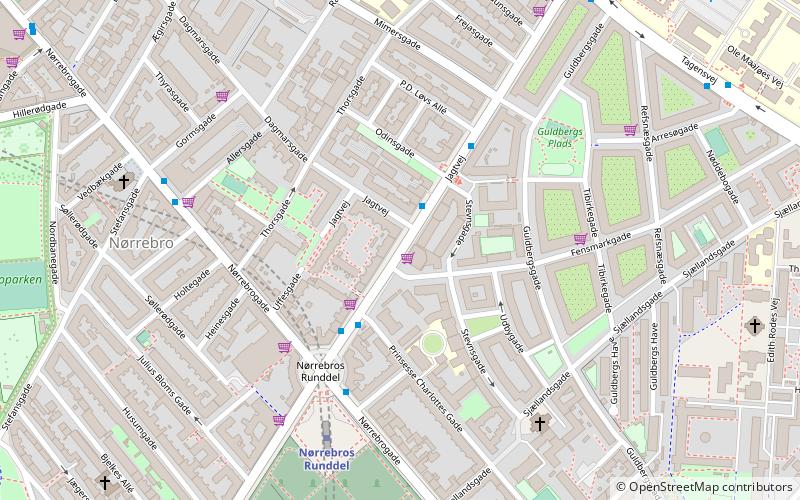
Jagtvej is a major artery in the Nørrebro and Østerbro districts of Copenhagen, Denmark. It runs from Agade on the border with Frederiksberg in the southwest to Østerbrogade in the northeast, linking Falkoner Allé with Strandboulevarden. The street passes Assistens Cemetery, University of Copenhagen's North Campus and Fælled Park. ()
Coordinates: 55°41'45"N, 12°33'2"E
Day trips
Jagtvej – popular in the area (distance from the attraction)
Nearby attractions include: Nørrebrogade, Nørrebro Bryghus, Stefanskirken, Assistens Cemetery.
Frequently Asked Questions (FAQ)
Which popular attractions are close to Jagtvej?
Nearby attractions include Thorsgade, Copenhagen (4 min walk), Prinsesse Charlottes Gade, Copenhagen (5 min walk), Sjællandsgade Bad, Copenhagen (6 min walk), Sjællandsgade, Copenhagen (6 min walk).
How to get to Jagtvej by public transport?
The nearest stations to Jagtvej:
Bus
Metro
Light rail
Train
Bus
- Stevnsgade • Lines: 18 (2 min walk)
- Nørrebros Runddel St. • Lines: 18, 5C (3 min walk)
Metro
- Nørrebros Runddel • Lines: M3 (5 min walk)
- Skjolds Plads • Lines: M3 (14 min walk)
Light rail
- Bispebjerg • Lines: F (21 min walk)
- Nørreport • Lines: A, B, Bx, C, E, H (31 min walk)
Train
- Nørreport (31 min walk)

 Metro
Metro


