Marmormolen, Copenhagen

Map
Facts and practical information
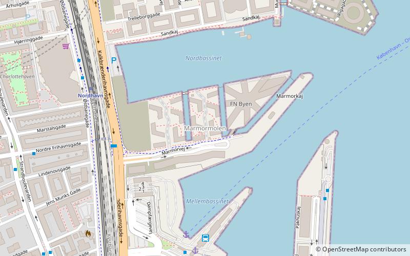
Marmormolen is a wharf in the Søndre Frihavn area of Copenhagen, Denmark. Currently under redevelopment, a new office building for the United Nations activities in Copenhagen is being built at its tip. The plans also include a highrise which will be connected to another highrise at the tip of Langelinie Pier across the entrance to the Søndre Frihavn dock by a pedestrian and cycling bridge 65 meters above the harbor. ()
Coordinates: 55°42'15"N, 12°35'45"E
Address
Østerbros (Nordhavn)Copenhagen
ContactAdd
Social media
Add
Day trips
Marmormolen – popular in the area (distance from the attraction)
Nearby attractions include: Maritime Monument, Paustian, Østerbrogade, Langelinie.
Frequently Asked Questions (FAQ)
Which popular attractions are close to Marmormolen?
Nearby attractions include Freeport of Copenhagen, Copenhagen (4 min walk), Amerika Plads, Copenhagen (8 min walk), Amerikakaj, Copenhagen (8 min walk), Strandboulevarden, Copenhagen (9 min walk).
How to get to Marmormolen by public transport?
The nearest stations to Marmormolen:
Bus
Light rail
Metro
Train
Ferry
Bus
- Port Copenhague (5 min walk)
- Færgeterminal Søndre Frihavn • Lines: 27 (6 min walk)
Light rail
- Nordhavn • Lines: A, B, Bx, C, E (6 min walk)
- Østerport • Lines: A, B, Bx, C, E, H (22 min walk)
Metro
- Nordhavn • Lines: M4 (8 min walk)
- Orientkaj • Lines: M4 (14 min walk)
Train
- Østerport (21 min walk)
Ferry
- Refshaleøen • Lines: 991, 992 (26 min walk)
- Nordre Toldbod • Lines: 991, 992 (29 min walk)
 Metro
Metro


