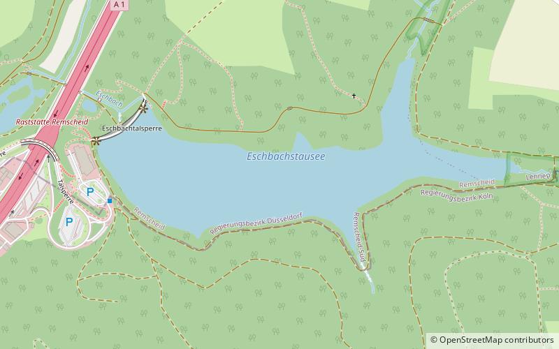
Eschbach Dam, Remscheid

Gallery (1)
Map
Map
Facts and practical information
Local name: Eschbachtalsperre Opened: 1891 (135 years ago)Length: 525 ftHeight: 82 ftReservoir area: 34.59 acres (0.0541 mi²)Elevation: 840 ft a.s.l.Coordinates: 51°9'32"N, 7°14'11"E
Address
Remscheid
ContactAdd
Social media
Add
Getting there by public transportation
Public transportation stops near this location
- Bus
 Bus
Bus
- Calculate routeGrenzwall / Tente 16 min walk
- Calculate routeBuchholzen 17 min walk
- Calculate routeStöcken 27 min walk
Day trips


Frequently Asked Questions (FAQ)
How to get to Eschbach Dam by public transport?
The nearest stations to Eschbach Dam:
Bus
Bus
- Grenzwall / Tente • Lines: 240 (16 min walk)
- Buchholzen • Lines: 240 (17 min walk)