Uhlandshöhe, Stuttgart
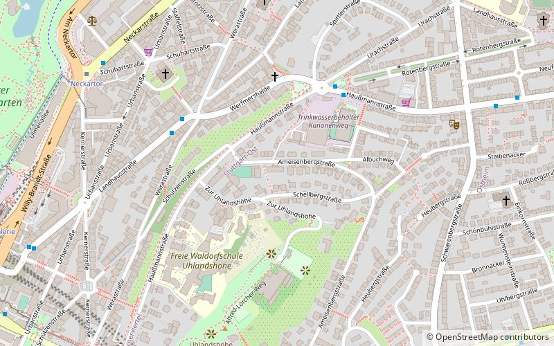
Map
Facts and practical information
The Uhlandshöhe is a hill in Baden-Württemberg, Germany. ()
Alternative names: Area: 101.31 acres (0.1583 mi²)Elevation: 1165 ftCoordinates: 48°47'3"N, 9°11'46"E
Address
Stüttgart Ost (Uhlandshöhe)Stuttgart
ContactAdd
Social media
Add
Getting there by public transportation
Public transportation stops near this location
- Bus
- Tram
- Light rail
- Train
 Bus
Bus
- Calculate routeUrachstraße 4 min walk
- Calculate routeFriedenstraße 5 min walk
- Calculate routeNeckartor 8 min walk
- Calculate routeNeckartor 8 min walk
- Calculate routeStöckach 9 min walk
- Calculate routeHeidehofstraße 11 min walk
- Calculate routeKarl-Olga-Krankenhaus 12 min walk
- Calculate routeStaatsgalerie 11 min walk
- Calculate routeStuttgart Main Station 15 min walk
- Calculate routeStuttgart Hauptbahnhof 19 min walk
- Calculate routeStuttgart Stadtmitte 31 min walk
- Calculate routeEugensplatz 13 min walk
- Calculate routeBudapester Platz 17 min walk
- Calculate routeBubenbad 20 min walk
- Calculate routeCharlottenplatz 21 min walk
Day trips


Frequently Asked Questions (FAQ)
Which popular attractions are close to Uhlandshöhe?
Nearby attractions include Sternwarte, Stuttgart (3 min walk), Planetarium, Stuttgart (11 min walk), Carl-Zeiss-Planetarium, Stuttgart (11 min walk), Grenadierregiement Königin Olga, Stuttgart (12 min walk).
How to get to Uhlandshöhe by public transport?
The nearest stations to Uhlandshöhe:
Bus
Light rail
Train
Tram
Bus
- Urachstraße • Lines: 42, N9 (4 min walk)
- Friedenstraße • Lines: 42, N9 (5 min walk)
Light rail
- Neckartor • Lines: U1, U11, U14, U2, U4, U9 (8 min walk)
- Stöckach • Lines: U1, U11, U14, U2, U4, U9 (9 min walk)
Train
- Staatsgalerie (11 min walk)
- Stuttgart Main Station (15 min walk)
Tram
- Eugensplatz • Lines: 23 (13 min walk)
- Budapester Platz • Lines: 23 (17 min walk)