Roosenbrücke, Hamburg

Gallery (2)
Map
Map
Gallery
Facts and practical information
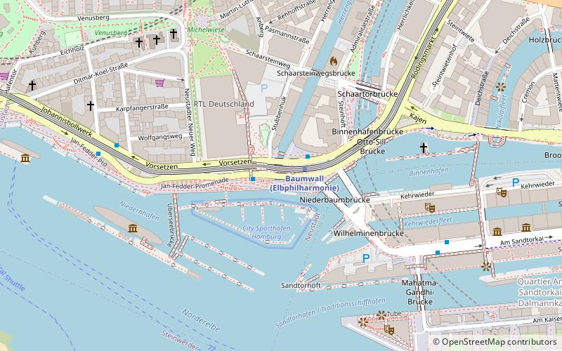
Baumwall is an approximately 180-meter-long inner-city street in the district of Hamburg-Neustadt and namesake of the subway station located here. As part of the Hafenrand road connection, Baumwall is part of Hamburg's main road network and bears the official key number B111. It is used by around 29,000 motor vehicles on weekdays.
Baumwall is named after an earlier city fortification from the 16th century. Due to its location on the edge of the harbor between Landungsbrücken, Speicherstadt and the Elbphilharmonie Concert Hall, it is an important tourist landmark, dominated by the Slomanhaus, an office building complex from 1910 that can be seen from afar.
Coordinates: 53°32'39"N, 9°58'51"E
Address
Hamburg-Mitte (Neustadt)Hamburg
ContactAdd
Social media
Add
Getting there by public transportation
Public transportation stops near this location
- Metro
- Bus
- Light rail
- Train
- Ferry
 Metro
Metro
- Calculate routeU Baumwall 1 min walk
- Calculate routeRambachstraße 6 min walk
- Calculate routeAm Kaiserkai 6 min walk
- Calculate routeMichaeliskirche 10 min walk
- Calculate routeBaumwall 1 min walk
- Calculate routeRödingsmarkt 10 min walk
- Calculate routeLandungsbrücken 11 min walk
- Calculate routeSt. Pauli 17 min walk
- Calculate routeStadthausbrücke 11 min walk
- Calculate routeLandungsbrücken 11 min walk
- Calculate routeSt. Pauli-Landungsbrücken 18 min walk
- Calculate routeJungfernstieg 21 min walk
- Calculate routeArgentinienbrücke 29 min walk
- Calculate routeAltona 31 min walk
- Calculate routeHamburg Central Station 32 min walk
- Calculate routeHamburg Dammtor / Universität 32 min walk
Day trips


Frequently Asked Questions (FAQ)
Which popular attractions are close to Roosenbrücke?
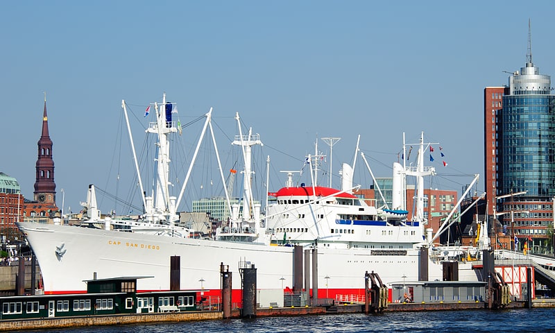
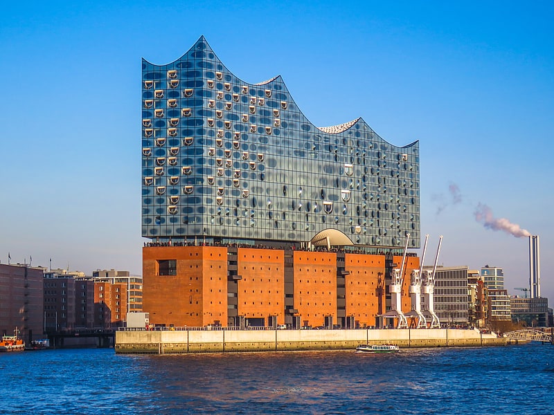
Nearby attractions include Flussschifferkirche, Hamburg (5 min walk), Hanseatic Trade Center, Hamburg (5 min walk), Cap San Diego, Hamburg (6 min walk), Elbphilharmonie, Hamburg (6 min walk).
How to get to Roosenbrücke by public transport?
The nearest stations to Roosenbrücke:
Bus
Metro
Light rail
Ferry
Train
Bus
- U Baumwall • Lines: 111, 2, 608 (1 min walk)
- Rambachstraße • Lines: 111, 2, 608 (6 min walk)
Metro
- Baumwall • Lines: U3 (1 min walk)
- Rödingsmarkt • Lines: U3 (10 min walk)
Light rail
- Stadthausbrücke • Lines: S1, S2, S3 (11 min walk)
- Landungsbrücken • Lines: S1, S2, S3 (11 min walk)
Ferry
- St. Pauli-Landungsbrücken • Lines: FRS HanseFerry (18 min walk)
- Jungfernstieg • Lines: Alsterkreuzfahrt (21 min walk)
Train
- Hamburg Central Station (32 min walk)
- Hamburg Dammtor / Universität (32 min walk)