Karls-Kapelle, Erkelenz

Gallery (1)
Map
Map
Facts and practical information
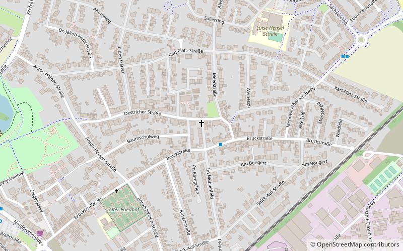
Karls-Kapelle is a place located in Erkelenz (North Rhine-Westphalia state) and belongs to the category of church.
It is situated at an altitude of 308 feet, and its geographical coordinates are 51°5'4"N latitude and 6°19'31"E longitude.
Planning a visit to this place, one can easily and conveniently get there by public transportation. Karls-Kapelle is a short distance from the following public transport stations: Brückstraße (bus, 2 min walk), Erkelenz (train, 15 min walk).
Among other places and attractions worth visiting in the area are: Hochkreuze (wayside shrine, 6 min walk), Alter Friedhof (cemetery, 6 min walk), Alte Stadtbefestigung (city wall, 11 min walk).
Coordinates: 51°5'4"N, 6°19'31"E
Getting there by public transportation
Public transportation stops near this location
- Bus
- Train
 Bus
Bus
- Calculate routeBrückstraße 2 min walk
- Calculate routeSalierring 8 min walk
- Calculate routeSachsenring 8 min walk
- Calculate routeAnton-Heinen-Straße 9 min walk
- Calculate routeErkelenz 15 min walk
Day trips


Frequently Asked Questions (FAQ)
Which popular attractions are close to Karls-Kapelle?
Nearby attractions include Hochkreuze, Erkelenz (6 min walk), Alter Friedhof, Erkelenz (6 min walk), Alte Stadtbefestigung, Erkelenz (11 min walk), Wayside cross, Erkelenz (11 min walk).
How to get to Karls-Kapelle by public transport?
The nearest stations to Karls-Kapelle:
Bus
Train
Bus
- Brückstraße • Lines: Ek 4 (2 min walk)
- Salierring • Lines: Ek 4 (8 min walk)
Train
- Erkelenz (15 min walk)