Wallanlage bei Müngsten, Remscheid

Gallery (1)
Map
Map
Facts and practical information
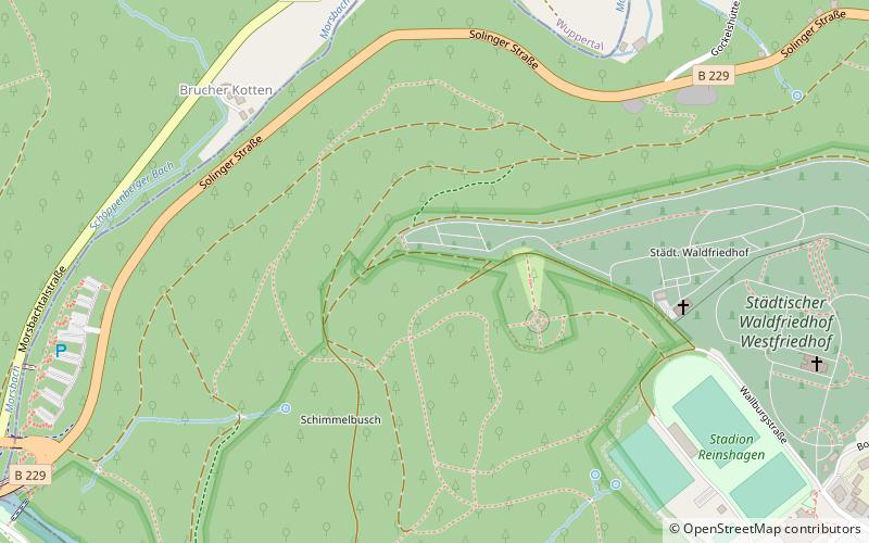
The Wallburg bei Müngsten is a departed rampart near Müngsten in the Reinshagen district of Remscheid.
Coordinates: 51°10'7"N, 7°8'40"E
Address
Remscheid
ContactAdd
Social media
Add
Getting there by public transportation
Public transportation stops near this location
- Bus
- Trolleybus
- Train
 Bus
Bus
- Calculate routeMorsbach Schleife 20 min walk
- Calculate routeAckerstraße Mitte 25 min walk
- Calculate routeReinshagen 27 min walk
- Calculate routePrangerkotten 29 min walk
- Calculate routeSolingen-Schaberg 21 min walk
- Calculate routeRemscheid-Güldenwerth 21 min walk
- Calculate routeDorperhof 36 min walk
- Calculate routeBirken 38 min walk
Day trips


Frequently Asked Questions (FAQ)
How to get to Wallanlage bei Müngsten by public transport?
The nearest stations to Wallanlage bei Müngsten:
Bus
Train
Trolleybus
Bus
- Morsbach Schleife • Lines: bRs (20 min walk)
- Ackerstraße Mitte • Lines: bRs (25 min walk)
Train
- Solingen-Schaberg (21 min walk)
- Remscheid-Güldenwerth (21 min walk)
Trolleybus
- Dorperhof • Lines: 683 (36 min walk)
- Birken • Lines: 683 (38 min walk)