Plauer See, Brandenburg an der Havel
Map

Map

Facts and practical information
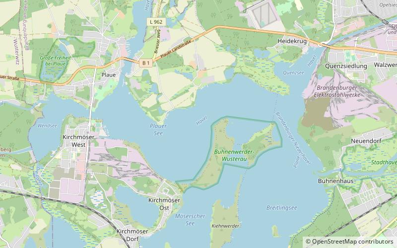
Plauer See is a lake in the state of Brandenburg, Germany. It is situated to the west of the city of Brandenburg an der Havel, and is one of a number of directly linked lakes, along with the Breitlingsee, Möserscher See, Quenzsee and Wendsee. ()
Alternative names: Area: 2.47 mi²Maximum depth: 22 ftElevation: 85 ft a.s.l.Coordinates: 52°23'55"N, 12°26'57"E
Address
Brandenburg an der Havel
ContactAdd
Social media
Add
Day trips
Plauer See – popular in the area (distance from the attraction)
Nearby attractions include: Brandenburg Euthanasia Centre, Wendsee, Quenzsee, Breitlingsee.
Frequently Asked Questions (FAQ)
How to get to Plauer See by public transport?
The nearest stations to Plauer See:
Bus
Bus
- Briester Weg • Lines: 571, E/525 (29 min walk)
- Grenzstraße • Lines: E/525 (32 min walk)


