Kellerberge, Penig

Gallery (2)
Map
Map
Gallery
Facts and practical information
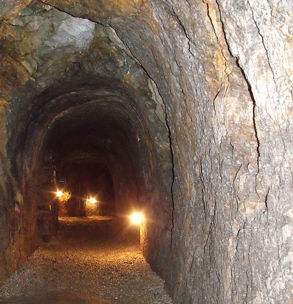
The Peniger Kellerberge are a system of underground passages in Penig.
Coordinates: 50°56'14"N, 12°41'56"E
Address
Penig
ContactAdd
Social media
Add
Day trips
The Peniger Kellerberge are a system of underground passages in Penig.
Penig
Where to next? Visit ![]() Saxony region page or discover the top tourist attractions in Germany.
Saxony region page or discover the top tourist attractions in Germany.


