Unterstadtkirche, Kleve
Map
Facts and practical information
Kleve is a town in the Lower Rhine region of northwestern Germany near the Dutch border and the River Rhine. From the 11th century onwards, Cleves was capital of a county and later a duchy. Today, Cleves is the capital of the district of Cleves in the German state of North Rhine-Westphalia. The city is home to one of the campuses of the Rhine-Waal University of Applied Sciences. ()
Getting there by public transportation
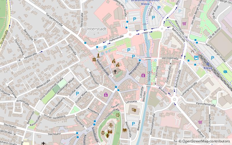
Public transportation stops near this location
- Bus
- Train
 Bus
Bus
- Calculate routeWasserstraße 2 min walk
- Calculate routeStadtinformation 3 min walk
- Calculate routeKoekkoek-Platz 3 min walk
- Calculate routeStadthalle 4 min walk
- Calculate routeDraisinenbahnhof Kleve 7 min walk
- Calculate routeKleve 8 min walk
Day trips


Frequently Asked Questions (FAQ)
When is Unterstadtkirche open?
Unterstadtkirche is open:
- Monday closed
- Tuesday closed
- Wednesday closed
- Thursday closed
- Friday 7:30 am - 6 pm
- Saturday closed
- Sunday closed
Which popular attractions are close to Unterstadtkirche?
Nearby attractions include B.C. Koekkoek-Haus, Kleve (3 min walk), Schwanenburg Castle, Kleve (5 min walk), Kleine Evangelische Kirche, Kleve (9 min walk), Collegiate Church, Kleve (9 min walk).
How to get to Unterstadtkirche by public transport?
The nearest stations to Unterstadtkirche:
Bus
Train
Bus
- Wasserstraße • Lines: 49 (2 min walk)
- Stadtinformation • Lines: 49 (3 min walk)
Train
- Draisinenbahnhof Kleve (7 min walk)
- Kleve (8 min walk)