Alaunplatz, Dresden
Map

Map

Facts and practical information
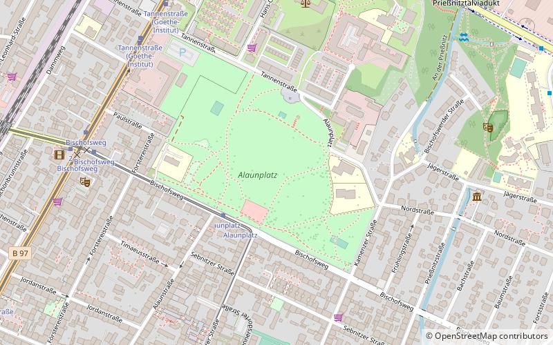
Alaunplatz is a square in the Dresden district of Äußere Neustadt. It is located between Kamenzer Straße and Tannenstraße and Bischofsweg. Alum Square is connected to Albert Square via the namesake Alum Street and borders the pub district of Äußere Neustadt to the north. Line 13 of the Dresden streetcar has a stop there called "Alaunplatz".
Since the former parade ground of the nearby Albertstadt barracks is landscaped with lawns and planted with shrubs and trees at the edges, the Alaunplatz is also called Alaunpark.
Elevation: 390 ft a.s.l.Coordinates: 51°4'15"N, 13°45'24"E
Day trips
Alaunplatz – popular in the area (distance from the attraction)
Nearby attractions include: Semperoper, Bundeswehr Military History Museum, Augustusbrücke, Three Kings' Church.
Frequently Asked Questions (FAQ)
When is Alaunplatz open?
Alaunplatz is open:
- Monday 24h
- Tuesday 24h
- Wednesday 24h
- Thursday 24h
- Friday 24h
- Saturday 24h
- Sunday 24h
Which popular attractions are close to Alaunplatz?
Nearby attractions include Kunsthofpassage, Dresden (7 min walk), Old Jewish Cemetery, Dresden (12 min walk), Theaterruine St. Pauli, Dresden (12 min walk), Bundeswehr Military History Museum, Dresden (14 min walk).
How to get to Alaunplatz by public transport?
The nearest stations to Alaunplatz:
Tram
Bus
Train
Ferry
Tram
- Alaunplatz • Lines: 13 (3 min walk)
- Bischofsweg • Lines: 13, 7, 8 (7 min walk)
Bus
- Arno-Holz-Allee • Lines: 74 (10 min walk)
- Marienallee • Lines: 74 (11 min walk)
Train
- Dresden Bischofsplatz (12 min walk)
- Dresden-Neustadt (21 min walk)
Ferry
- Fähre Neustadt-Johannstadt • Lines: Johannstadt - Neustadt (18 min walk)
- Fähre Johannstadt-Neustadt • Lines: Johannstadt - Neustadt (20 min walk)


