Fußfallstationen Süchteln, Viersen

Gallery (1)
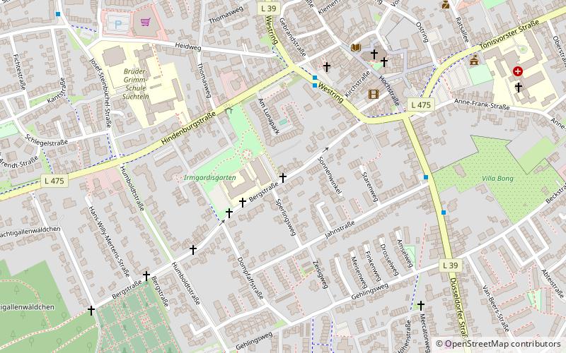
Map
Map
Facts and practical information
Fußfallstationen Süchteln is a place located in Viersen (North Rhine-Westphalia state) and belongs to the category of wayside shrine.
It is situated at an altitude of 151 feet, and its geographical coordinates are 51°17'1"N latitude and 6°22'5"E longitude.
Planning a visit to this place, one can easily and conveniently get there by public transportation. Fußfallstationen Süchteln is a short distance from the following public transport stations: Thomasweg (bus, 3 min walk).
Among other places and attractions worth visiting in the area are: Fußfallstationen Süchteln (wayside shrine, 11 min walk), Hochkreuz (wayside shrine, 13 min walk), Irmgardiskapelle (church, 14 min walk).
Coordinates: 51°17'1"N, 6°22'5"E
Address
Viersen
ContactAdd
Social media
Add
Getting there by public transportation
Public transportation stops near this location
- Bus
 Bus
Bus
- Calculate routeThomasweg 3 min walk
- Calculate routeWestring Jugendheim 4 min walk
- Calculate routeJahnstraße 6 min walk
Day trips


Frequently Asked Questions (FAQ)
Which popular attractions are close to Fußfallstationen Süchteln?
Nearby attractions include Fußfallstationen Süchteln, Viersen (11 min walk), Hochkreuz, Viersen (13 min walk), Irmgardiskapelle, Viersen (14 min walk), Süchteln, Viersen (17 min walk).
How to get to Fußfallstationen Süchteln by public transport?
The nearest stations to Fußfallstationen Süchteln:
Bus
Bus
- Thomasweg • Lines: 009, 019 (3 min walk)
- Westring Jugendheim • Lines: 009, 019 (4 min walk)