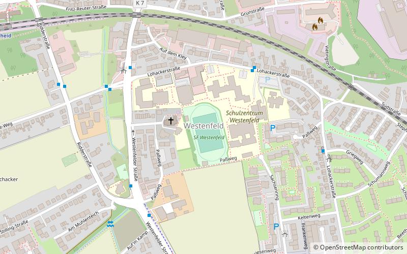
Bochum-Westenfeld, Bochum
Map
Facts and practical information
Westenfeld is a part of the former town of Wattenscheid in the Ruhr area in Germany. Westenfeld now belongs to the city of Bochum. Westenfeld has the railway station in Wattenscheid which is most frequented by passengers. Westenfeld is one of the most important areas of the German textile industry. Sevinghausen is a rural part of Wattenscheid not belonging to Westenfeld. ()
Address
Wattenscheid (Westenfeld)Bochum
ContactAdd
Social media
Add
Getting there by public transportation
Public transportation stops near this location
- Bus
- Tram
- Train
 Bus
Bus
- Calculate routeAuf dem Kley 4 min walk
- Calculate routeLohackerstraße 5 min walk
- Calculate routeKeltenweg 7 min walk
- Calculate routeWattenscheid 11 min walk
- Calculate routeWattenscheid-Höntrop 20 min walk
- Calculate routeHöntrop Kirche 12 min walk
- Calculate routeBrucknerstraße 13 min walk
- Calculate routeVietingstraße 16 min walk
- Calculate routeRöntgenstraße 16 min walk
Day trips


Frequently Asked Questions (FAQ)
How to get to Bochum-Westenfeld by public transport?
The nearest stations to Bochum-Westenfeld:
Bus
Train
Tram
Bus
- Auf dem Kley • Lines: 365, 386, Ne6 (4 min walk)
- Lohackerstraße • Lines: 344, 365, 389 (5 min walk)
Train
- Wattenscheid (11 min walk)
- Wattenscheid-Höntrop (20 min walk)
Tram
- Höntrop Kirche • Lines: 305, 310 (12 min walk)
- Brucknerstraße • Lines: 305, 310 (13 min walk)