Virneburg
#2692 among destinations in Germany


Facts and practical information
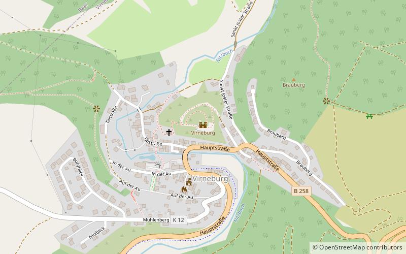
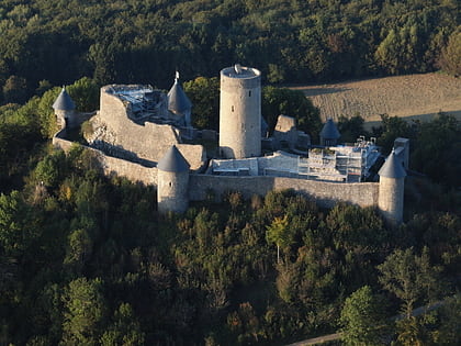
Virneburg Castle is a ruined hill castle on a slate hill, 430 m above sea level, around which the Nitzbach stream flows. It stands above the village of Virneburg in the county of Mayen-Koblenz in the German state of Rhineland-Palatinate. ()
Rhineland-PalatinateGermany
Virneburg – popular in the area (distance from the attraction)
Nearby attractions include: Nürburg Castle, Hohe Acht, Hochsimmer, Raßberg.
 Forts and castles
Nürburg Castle, Nürburg
142 min walk • The Nürburg is a ruined hilltop castle in the German Eifel Mountains near the village of Nürburg south of Adenau in the district of Ahrweiler in the state of Rhineland-Palatinate. It stands within the famous North Loop, or Nordschleife, of the Nürburgring racing course at an altitude of 678 m on a volcanic basalt cone.
 Nature, Natural attraction, Mountain
Hohe Acht
108 min walk • Nestled within the verdant landscape of the Eifel region in Germany, Hohe Acht stands as the highest mountain in the area, reaching an elevation of 747 meters. This serene peak offers a respite from the hustle and bustle of everyday life and is a popular destination...
 Nature, Natural attraction, Mountain
Hochsimmer
140 min walk • The Hochsimmer is a volcanic cone, 587.9 m above sea level, in the Eifel Mountains in Germany. It rises near Ettringen in the Rhineland-Palatine county of Mayen-Koblenz. At the summit is an observation tower, the Hochsimmer Tower.
 Nature, Natural attraction, Mountain
Raßberg
84 min walk • At 668 m above sea level the Raßberg is one of the highest mountains in the Eifel region on the German and Belgian border. It lies within the municipality of Arft in the collective municipality of Vordereifel within sight of the Eifel's highest peak, the Hohe Acht.
 Natural attraction, Mountain
Hochkelberg, Mosbrucher Weiher
188 min walk • At 674.9 metres the Hochkelberg is one of the ten highest mountains in the Vulkan Eifel in Germany. It is a former stratovolcano, at the southern foot of which lies the Mosbrucher Weiher, an explosion crater lake or maar.
 Tower
TowerGoose Neck Tower
170 min walk • Goose Neck Tower is an 87-metre concrete radio tower near Bell and Mendig in Western Germany. Built in 1976, it serves as an internal radio relay link for German electric and natural gas public utility company RWE.
 Church
Pfarrkirche Heiligste Dreifaltigkeit, Monreal
118 min walk • The Holy Trinity Roman Catholic parish church in Monreal, a local community in the Mayen-Koblenz district of Rhineland-Palatinate, is built in the Gothic style and has numerous original furnishings.
 Forts and castles
Löwenburg, Monreal
119 min walk • On a hill spur above the Eifel village of Monreal in Germany's Elzbach valley, at a height of 350 m above sea level, stand two neighbouring ruined hill castles: the Löwenburg, also called Monreal Castle, and the Philippsburg. The latter is also known locally as das Rech.
 Forts and castles
Schloss Bürresheim, Mayen
115 min walk • Bürresheim Castle is a medieval castle northwest of Mayen, Rheinland-Pfalz, Germany. It is built on rock in the Eifel mountains above the Nette. Bürresheim Castle, Eltz Castle and Lissingen Castle are the only castles on the left bank of the Rhine in Rhineland-Palatinate which have never been destroyed.
 View point
Booser Eifelturm, Booser Doppelmaar
92 min walk • The Boos Eiffel Tower near Boos in the Volcanic Eifel is a 25-meter-high observation tower.
 Forts and castles
Philipsburg, Monreal
116 min walk • On a hill spur above the Eifel village of Monreal in Germany's Elzbach valley, at a height of 350 m above sea level, stand two neighbouring ruined hill castles: the Löwenburg, also called Monreal Castle, and the Philippsburg. The latter is also known locally as das Rech.
