Luisenstadt, Berlin
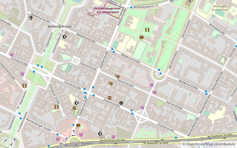
Map
Facts and practical information
Luisenstadt is a former quarter of central Berlin, now divided between the present localities of Mitte and Kreuzberg. It gave its name to the Luisenstadt Canal and the Luisenstädtische Kirche. ()
Address
Friedrichshain-Kreuzberg (Kreuzberg)Berlin
ContactAdd
Social media
Add
Getting there by public transportation
Public transportation stops near this location
- Metro
- Tram
- Train
 Metro
Metro
- Calculate routeU Kottbusser Tor 7 min walk
- Calculate routeU Görlitzer Bahnhof 9 min walk
- Calculate routeU Moritzplatz 12 min walk
- Calculate routeU Schönleinstraße 16 min walk
- Calculate routeBerlin Ostbahnhof 21 min walk
- Calculate routeS+U Warschauer Straße 30 min walk
Maps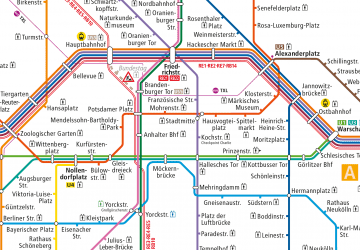 Metro
Metro
MetroDay trips


Frequently Asked Questions (FAQ)
Which popular attractions are close to Luisenstadt?
Nearby attractions include Kreuzberg Museum, Berlin (5 min walk), Drachenbrunnen, Berlin (6 min walk), Oranienplatz, Berlin (7 min walk), Indischer Brunnen, Berlin (7 min walk).
How to get to Luisenstadt by public transport?
The nearest stations to Luisenstadt:
Metro
Train
Tram
Metro
- U Kottbusser Tor • Lines: U1, U3, U8 (7 min walk)
- U Görlitzer Bahnhof • Lines: U1, U3 (9 min walk)
Train
- Berlin Ostbahnhof (21 min walk)
Tram
- S+U Warschauer Straße • Lines: M10 (30 min walk)