Hohler Stein
Map

Gallery

Facts and practical information
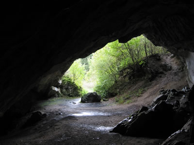
The Hohle Stein in the Kallenhardt district of the North Rhine-Westphalian municipality of Rüthen is a large cultural cave that has yielded archaeological finds from the late Paleolithic to the pre-Roman Iron Age. The Hohle Stein is located in the Lörmecke Valley nature reserve and FFH area, which also contains - just a few hundred meters away - the Hoher Stein rock formation.
Coordinates: 51°26'10"N, 8°24'11"E
Day trips
Hohler Stein – popular in the area (distance from the attraction)
Nearby attractions include: Plackweghöhe, Haus Ostwig, Schloss Körtlinghausen, Arnsberg Forest Nature Park.


