Hartenberg-Münchfeld, Mainz
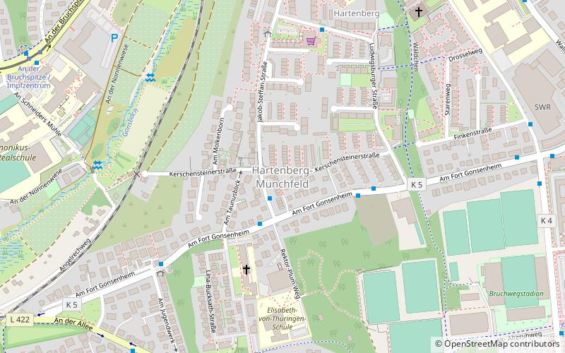
Map
Facts and practical information
Getting there by public transportation
Public transportation stops near this location
- Bus
- Tram
- Train
 Bus
Bus
- Calculate routeHartenberg/Ketteler-Kolleg 2 min walk
- Calculate routeLudwigsburger Straße 4 min walk
- Calculate routeEduard-David-Straße 6 min walk
- Calculate routeAm Jugendwerk 6 min walk
- Calculate routeAn der Bruchspitze / Impfzentrum 10 min walk
- Calculate routeGonsbachgärten 13 min walk
- Calculate routeUniversität B 15 min walk
- Calculate routeMainz-Waggonfabrik 21 min walk
- Calculate routeMainz Hbf 24 min walk
- Calculate routeMainz-Gonsenheim 29 min walk
- Calculate routeMainz Nord 32 min walk
Day trips


Frequently Asked Questions (FAQ)
Which popular attractions are close to Hartenberg-Münchfeld?
Nearby attractions include Bruchwegstadion, Mainz (10 min walk), Old Jewish Cemetery, Mainz (17 min walk), St. Petrus Canisius, Mainz (19 min walk), Hauptfriedhof, Mainz (20 min walk).
How to get to Hartenberg-Münchfeld by public transport?
The nearest stations to Hartenberg-Münchfeld:
Bus
Tram
Train
Bus
- Hartenberg/Ketteler-Kolleg • Lines: 64, 65, 68, 93 (2 min walk)
- Ludwigsburger Straße • Lines: 64, 65, 68 (4 min walk)
Tram
- An der Bruchspitze / Impfzentrum • Lines: 50, 51 (10 min walk)
- Gonsbachgärten • Lines: 50, 51 (13 min walk)
Train
- Mainz-Waggonfabrik (21 min walk)
- Mainz Hbf (24 min walk)