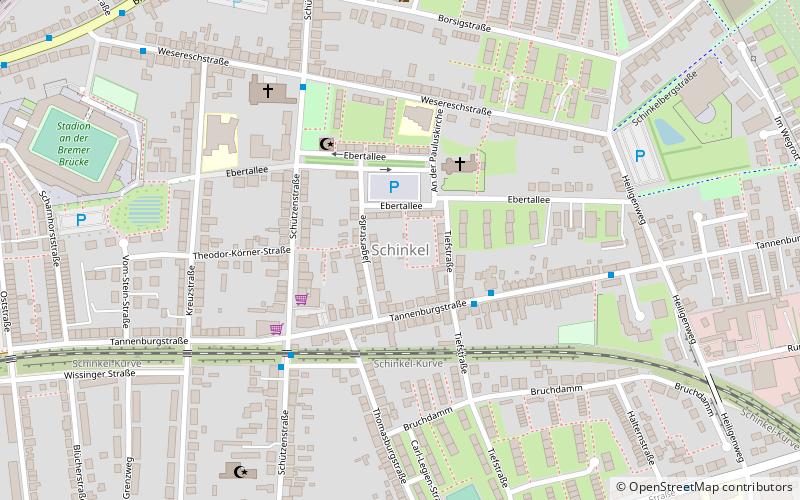
Schinkel, Osnabrück
Map
Facts and practical information
Schinkel is a district of Osnabrück, Germany, first mentioned in records in 1332. It is situated in the east of the city, into which it was incorporated on 1 April 1914. There are roughly 13,300 people in Schinkel. ()
Address
Ost (Schinkel)Osnabrück
ContactAdd
Social media
Add
Getting there by public transportation
Public transportation stops near this location
- Bus
- Train
 Bus
Bus
- Calculate routeTiefstraße 3 min walk
- Calculate routeTannenburgstraße 4 min walk
- Calculate routeKreuzkirche 5 min walk
- Calculate routeSophienhof 5 min walk
- Calculate routeOsnabrück Hauptbahnhof 22 min walk
Day trips


Frequently Asked Questions (FAQ)
How to get to Schinkel by public transport?
The nearest stations to Schinkel:
Bus
Train
Bus
- Tiefstraße • Lines: M3, N3 (3 min walk)
- Tannenburgstraße • Lines: 10, 20, M3, N3 (4 min walk)
Train
- Osnabrück Hauptbahnhof (22 min walk)