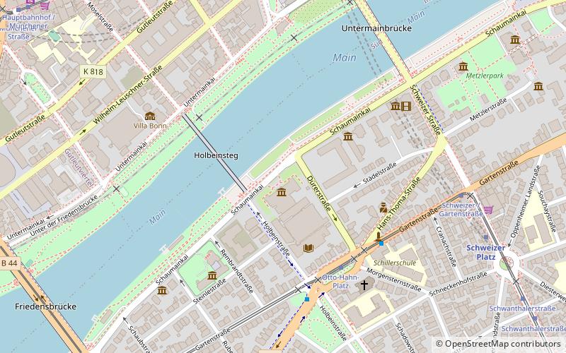
Schaumainkai, Frankfurt
Map

Map

Facts and practical information
Schaumainkai is a street in central Frankfurt, Germany, running along the south side of the river Main. It includes a number of museums including the Städel, a leading art gallery. Because of the large concentration of museums on the riverside, the area is called Museumsufer. ()
Elevation: 331 ft a.s.l.Coordinates: 50°6'13"N, 8°40'26"E
Address
Süd (Sachsenhausen-Nord)Frankfurt
ContactAdd
Social media
Add
Day trips
Schaumainkai – popular in the area (distance from the attraction)
Nearby attractions include: Städel Museum, Museum Angewandte Kunst, Deutsches Filmmuseum, Weltkulturen Museum.
Frequently Asked Questions (FAQ)
Which popular attractions are close to Schaumainkai?
Nearby attractions include Städel Museum, Frankfurt (1 min walk), Holbeinsteg, Frankfurt (3 min walk), Museum für Kommunikation, Frankfurt (3 min walk), Liebieghaus, Frankfurt (4 min walk).
How to get to Schaumainkai by public transport?
The nearest stations to Schaumainkai:
Tram
Bus
Metro
Train
Tram
- Otto-Hahn-Platz • Lines: 15, 16, 19, EEx (4 min walk)
- Schweizer-/Gartenstraße • Lines: 15, 16, 19, EEx (7 min walk)
Bus
- Otto-Hahn-Platz • Lines: N16 (4 min walk)
- Schweizer-/Gartenstraße • Lines: N16 (6 min walk)
Metro
- Schweizer Platz • Lines: U1, U2, U3, U8 (8 min walk)
- Willy-Brandt-Platz • Lines: U1, U2, U3, U4, U5, U8 (10 min walk)
Train
- Frankfurt Eiserner Steg (14 min walk)
- Frankfurt Hauptbahnhof (14 min walk)


