DY Patil Stadium, Mumbai

Facts and practical information
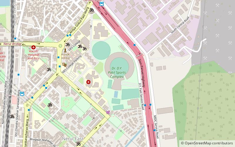
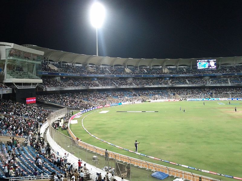
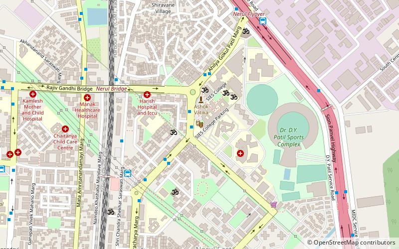
The DY Patil Stadium stands as a modern coliseum in the bustling city of Mumbai, India, epitomizing the country's passion for sports. Inaugurated in 2008, this state-of-the-art venue has quickly become a premier location for various sporting events, most notably cricket, a sport that commands a near-religious following in the nation.
Constructed with meticulous attention to detail, the stadium features a seating capacity of around 55,000 spectators. Its innovative cantilevered roof ensures an unobstructed view of the field from every seat, a feature that enhances the spectator experience. Additionally, the stadium is equipped with more than 70 corporate boxes for VIP guests, adding a touch of luxury to the thrilling ambiance of live sports.
DY Patil Stadium is not just a sports venue; it is also an architectural marvel in its own right. The design of the stadium incorporates cutting-edge facilities, including high-quality pitch lighting and a drainage system that ensures the ground remains playable even during the monsoon season. These features make it an ideal venue for both day and night matches.
The stadium has hosted numerous high-profile cricket matches, including fixtures from the Indian Premier League (IPL) and international contests. It has also served as a platform for large-scale entertainment events, such as concerts, making it a versatile addition to Mumbai's cultural landscape.
Accessibility is a key factor in the stadium's design, with ample parking and efficient transport links that cater to the large crowds it attracts. The DY Patil Stadium is not just a hub for sports; it's a beacon that highlights Mumbai's status as a city that embraces modernity while fostering the spirit of competition and sportsmanship.
- Bus
- Train
 Bus
Bus
- Calculate routeNerul L.P 10 min walk
- Calculate routeNerul Bus Station 12 min walk
- Calculate routeSarsole Bus Station 21 min walk
- Calculate routeArtist Colony Sector-8 Depot 30 min walk
- Calculate routeNerul 20 min walk
- Calculate routeJuinagar 29 min walk


Frequently Asked Questions (FAQ)
Which popular attractions are close to DY Patil Stadium?
How to get to DY Patil Stadium by public transport?
Bus
- Nerul L.P (10 min walk)
- Nerul Bus Station (12 min walk)
Train
- Nerul (20 min walk)
- Juinagar (29 min walk)