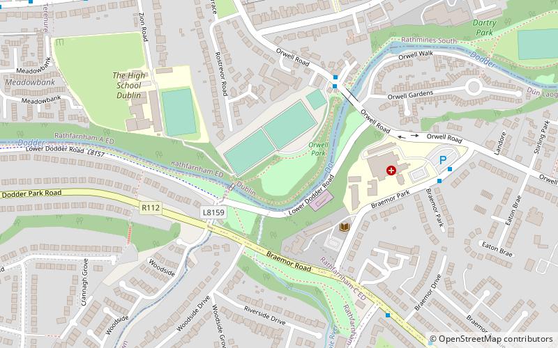
Orwell Healthcare, Dublin

Gallery (1)
Map
Map
Facts and practical information
Orwell Healthcare (address: 112 Orwell Road) is a place located in Dublin (Dublin county) and belongs to the category of park, relax in park.
It is situated at an altitude of 112 feet, and its geographical coordinates are 53°18'16"N latitude and 6°16'8"W longitude.
Planning a visit to this place, one can easily and conveniently get there by public transportation. Orwell Healthcare is a short distance from the following public transport stations: Rathfarham Road, Dodder Bridge (bus, 16 min walk), Windy Arbour (tram, 20 min walk).
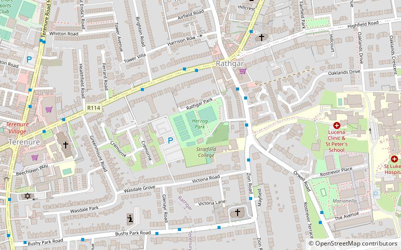
Among other places and attractions worth visiting in the area are: Herzog Park (park, 13 min walk), Rathgar (village, 15 min walk), Classon's Bridge (bridge, 17 min walk).
Elevation: 112 ft a.s.l.Coordinates: 53°18'16"N, 6°16'8"W
Getting there by public transportation
Public transportation stops near this location
- Bus
- Tram
 Bus
Bus
- Calculate routeRathfarham Road, Dodder Bridge 16 min walk
- Calculate routeRathfarnham Road, Rathdown Park 16 min walk
- Calculate routeWindy Arbour 20 min walk
- Calculate routeMilltown 21 min walk
- Calculate routeCowper 27 min walk
- Calculate routeBeechwood 33 min walk
Day trips


Frequently Asked Questions (FAQ)
Which popular attractions are close to Orwell Healthcare?
Nearby attractions include Herzog Park, Dublin (13 min walk), Rathgar, Dublin (15 min walk), Classon's Bridge, Dublin (17 min walk), Trinity Hall, Dublin (17 min walk).
How to get to Orwell Healthcare by public transport?
The nearest stations to Orwell Healthcare:
Bus
Tram
Bus
- Rathfarham Road, Dodder Bridge • Lines: 16, 17, 17D (16 min walk)
- Rathfarnham Road, Rathdown Park • Lines: 16 (16 min walk)
Tram
- Windy Arbour • Lines: Luas Green Line (20 min walk)
- Milltown • Lines: Luas Green Line (21 min walk)