Rakoń / Rákoň, Tatra National Park


Facts and practical information
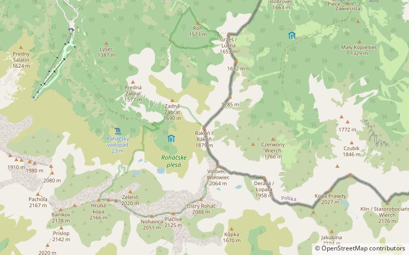
Rakoń - a poorly distinguished peak in the Western Tatras, located in the side northern ridge of Wołowiec. Through this ridge runs the Polish-Slovakian border. Rakoń is separated from Wołowiec by a small pass called Zawracie, over which it rises only 16 meters, while in the direction of the neighboring in the south Grześ runs the ridge of Długie Upłazu with Łuczniańska Pass. In north-western direction from the Rakoń there is one more ridge, the north-western Rakoń ridge, separating the Slovak valleys: Latana and Rohacka. Its eastern slopes descend to the Chochołowska Valley Higher.
The slopes of Rakoń are relatively gentle, in the upper part grassy with clumps of dwarf pine, here and there protruding single rocks and small rock rubble. In the past they were grazed, from the Polish side they were pastoral areas of Hala Chochołowska. To the west and south there are wide views of Rohace ponds and surprisingly wild-looking Rohace, more resembling peaks of the High Tatras. The views in other directions are equally wide. The slopes of the Western Tatras around Rakon look especially colourful in autumn when they change their colors: clumps of blueberries turn bright red, heather blossoms violet, rush is coloured red, dog grass is yellow, and all this against a background of dark green dwarf pine.
The border route through Grześ, Rakoń, Wołowiec, Łopata, Jarząbczy Wierch and Kończysty Wierch is often visited by the Polish and Slovakian tourists. To pass the whole stretch one needs to be in good condition because of its length and the sum of altitudes, that is why many tourists reach only Wołowiec and turn back. Increased traffic on the Slovak side is the result of building in 1968-1970 a road to the foot of the peak.
Tatra National Park
Rakoń / Rákoň – popular in the area (distance from the attraction)
Nearby attractions include: PTTK at Polanie Chochołowskiej, Končistá / Kończysty Wierch, Trzydniowiański Wierch, Kotłowa Czubka.


