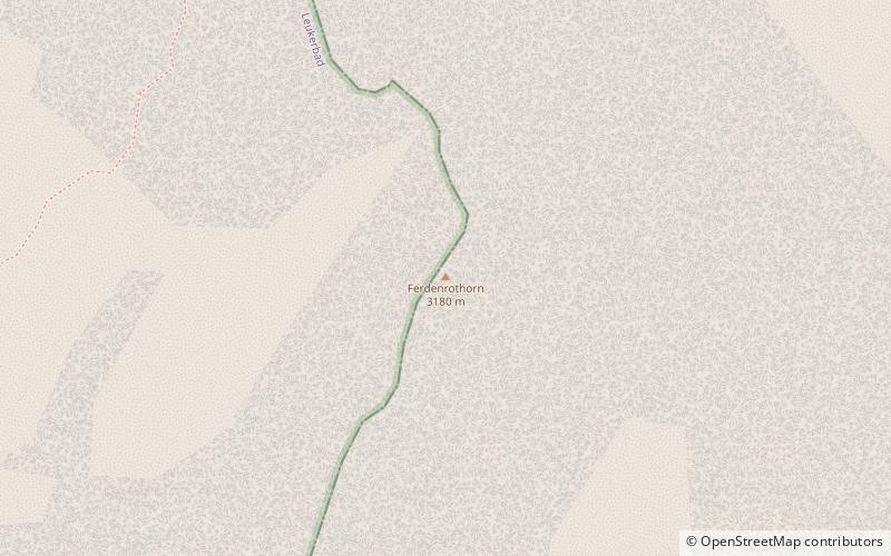
Ferdenrothorn
Map
![Ferdenrothorn location map](https://tzmedia.b-cdn.net/media/images/static-maps/ch/46_4083_7_70726.jpg)
Map
![Ferdenrothorn location map](https://tzmedia.b-cdn.net/media/images/static-maps/ch/46_4083_7_70726.jpg)
Facts and practical information
Location
Valais
ContactAdd
Social media
Add
Day trips
Ferdenrothorn – popular in the area (distance from the attraction)
Nearby attractions include: Daubensee, Balmhorn, Torrenthorn, Altels.
#1501 among destinations in Switzerland
ValaisSwitzerland
Unleash the traveler in you — discover the cheapest flight deals, find the perfect hotel or hostel nearby, and search for the best car rental prices. Travel at your own pace to discover new places and enjoy your journey.
Nearby attractions include: Daubensee, Balmhorn, Torrenthorn, Altels.
108 min walk • Nestled in the heart of the Swiss Alps, Daubensee, also known as Lake Dauben, is a serene mountain lake that offers a tranquil escape from the bustle of urban life. Situated at an elevation of approximately 2207 meters above sea level, this alpine gem is a popular...
34 min walk • The Balmhorn is a mountain in the Bernese Alps in Switzerland. Its summit ridge lies on the border between the cantons of Berne and the Valais.
65 min walk • The Torrenthorn is a mountain of the Bernese Alps, overlooking Leukerbad in the canton of Valais. It lies south of the Majinghorn. In winter the Torrenthorn is part of a ski area.
51 min walk • The Altels is a mountain of the Bernese Alps, located on the border between the Swiss cantons of Bern and Valais. It is situated in the Balmhorn massif, approximately halfway between Kandersteg and Leukerbad.
66 min walk • The Hockenhorn is a mountain of the Bernese Alps, located on the border between the Swiss cantons of Bern and Valais. Its summit is 3,293 metres high and lies between the upper Kandertal and the Lötschental.
65 min walk • The Rinderhorn is a mountain of the Bernese Alps, overlooking Leukerbad in the canton of Valais. It lies east of Gemmi Pass on the chain culminating at the Balmhorn.
84 min walk • The Niwen is a mountain of the Bernese Alps, overlooking the Rhone in the upper canton of Valais. It lies in the massif that separates the valley of Leukerbad from the lower Lötschental and that culminates at the Ferdenrothorn.
112 min walk • Gemmi Pass is a high mountain pass across the Bernese Alps connecting Leukerbad in the canton of Valais with Kandersteg in the canton of Bern. The pass itself lies within the canton of Valais, at a height of 2,270 metres above sea level. The main trail reaches 2,322 metres.
112 min walk • The Doldenhorn is a mountain of the Bernese Alps, overlooking Kandersteg in the Bernese Oberland. On its north side is Lake Oeschinen.
125 min walk • The Birghorn is a mountain of the Bernese Alps, located on the border between the Swiss cantons of Bern and Valais. It lies on the range connecting the Lötschen Pass from the Tschingelhorn, separating the upper Gasterntal from the Lötschental.
Where to next? Visit Valais region page or discover the top tourist attractions in Switzerland.