Gärsthorn
#1564 among destinations in Switzerland


Facts and practical information
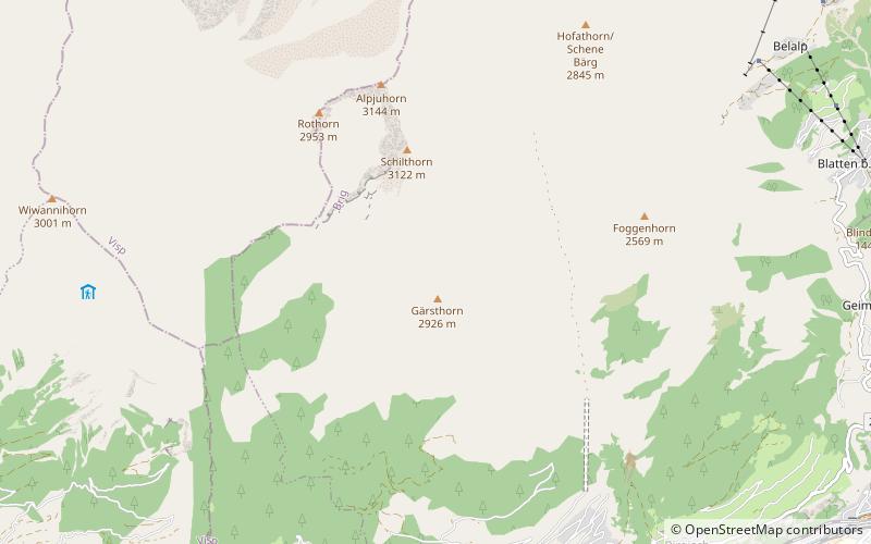
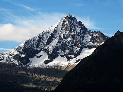
The Gärsthorn is a mountain of the Bernese Alps, overlooking Mund in the canton of Valais. The main summit has an elevation of 2,964 metres, while the southern summit has an elevation of 2,927 metres. ()
ValaisSwitzerland
Gärsthorn – popular in the area (distance from the attraction)
Nearby attractions include: Stockalper Palace, Bietschhorn, Sparrhorn, Hohstock.
 Forts and castles, Museum, History museum
Stockalper Palace, Brig
106 min walk • Nestled in the historic town of Brig, Switzerland, the Stockalper Palace stands as a testament to the grandeur of the Baroque era. This magnificent castle, with its imposing structure and intricate design, is a must-visit landmark for any traveler exploring the Valais...

4.4 miNW , Natural attraction, MountainBietschhorn, Lötschental
113 min walk • The Bietschhorn is a mountain in canton Wallis to the south of the Bernese Alps in Switzerland. The northeast and southern slopes of the mountain are part of the Jungfrau-Aletsch Protected Area listed as a UNESCO World Heritage Site that also includes the Jungfrau and the Aletsch Glacier.
 Nature, Natural attraction, Mountain
Sparrhorn
131 min walk • The Sparrhorn is a mountain of the Bernese Alps, located north of Belalp in the canton of Valais. It lies at the eastern end of the range located south of the Oberaletsch Glacier, west of the Aletsch Glacier. From Belalp a trail leads to its summit.
 Nature, Natural attraction, Mountain
Hohstock
120 min walk • The Hohstock is a mountain of the Bernese Alps, located north of Belalp in the Swiss canton of Valais. It lies on the range east of the Unterbächhorn, between the valley of the Oberaletsch Glacier and the cirque of Belalp.
 Nature, Natural attraction, Lake
Stausee Gibidum
116 min walk • Stausee Gibidum is a reservoir in the canton of Valais, Switzerland. Its surface area is 0.21 km², shared by the municipalities of Naters and Riederalp. The construction of Gebidem dam was started in 1964 and completed by 1967. The arch dam has an elevation of 122 m and a crest length of 327 m.
 Nature, Natural attraction, Mountain
Riederhorn
129 min walk • The Riederhorn is a mountain of the Bernese Alps, overlooking Riederalp in the canton of Valais. It lies near the western end of the chain south of the Aletsch Glacier.
 Hiking, Alpine hut
Baltschieder Hut
91 min walk • The Baltschieder Hut is a mountain hut of the Swiss Alpine Club, located north of Baltschieder in the canton of Valais. It lies at a height of 2,783 metres above sea level, at the end of the Baltschiedertal near the Bietschhorn.
 Nature, Natural attraction, Mountain
Wiwannihorn
75 min walk • The Wiwannihorn is a mountain of the Pennine Alps, located north of Ausserberg in the canton of Valais. It lies on the range between the Bietschtal and the Baltschiedertal, south of the Bietschhorn.
 Nature, Natural attraction, Mountain
Nesthorn
116 min walk • The Nesthorn is a mountain in the Bernese Alps. It is located in the Swiss canton of Valais north of Brig. The mountain lies between the Oberaletsch Glacier on the north and east side and the Gredetschtal on the south side.
 Natural feature
Oberaletsch Glacier, Swiss Alps Jungfrau-Aletsch
137 min walk • The Oberaletsch Glacier is a valley glacier on the south side of the Bernese Alps, in the canton of Valais. It had a length of 9 km with an average width of just under 1 km and an area of about 22 km² in 1973.
 Nature, Natural attraction, Mountain
Breithorn
131 min walk • The Breithorn is a mountain of the Bernese Alps, located east of Blatten in the canton of Valais. It lies between the Bietschhorn and the Schinhorn, on the range separating the Lötschental from the main Rhone valley.
