Mont de l'Etoile
#1116 among destinations in Switzerland

Facts and practical information
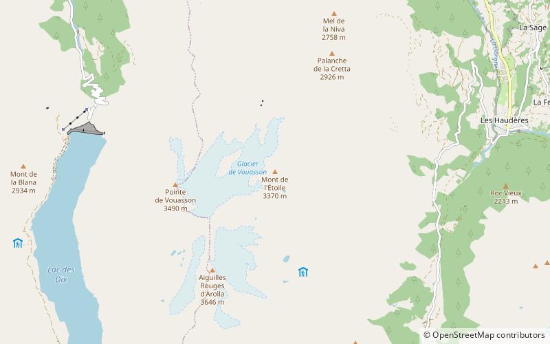
Mont de l'Etoile is a mountain of the Swiss Pennine Alps, located west of Les Haudères in the canton of Valais. On its west side lies a glacier named Glacier de Vouasson. ()
ValaisSwitzerland
Mont de l'Etoile – popular in the area (distance from the attraction)
Nearby attractions include: Grande Dixence Dam, Aiguille de la Tsa, Rosablanche, La Luette.
 Dam, Bridge
Grande Dixence Dam
59 min walk • The Grande Dixence Dam is a concrete gravity dam on the Dixence at the head of the Val d'Hérémence in the canton of Valais in Switzerland. At 285 m high, it is the tallest gravity dam in the world, fifth tallest dam overall, and the tallest dam in Europe. It is part of the Cleuson-Dixence Complex.
 Nature, Natural attraction, Mountain
Aiguille de la Tsa
128 min walk • The Aiguille de la Tsa is a mountain of the Swiss Pennine Alps, overlooking Arolla in the canton of Valais. It lies on the range culminating at the Dent de Perroc, between the valley of Arolla and the Mont Miné Glacier.
 Nature, Natural attraction, Mountain
Rosablanche
120 min walk • The Rosablanche is a mountain of the Swiss Pennine Alps, overlooking the Lac des Dix in the canton of Valais. It lies on the range between the valleys of Bagnes and Hérémence, north of Le Pleureur.
 Nature, Natural attraction, Mountain
La Luette
136 min walk • La Luette is a mountain of the Pennine Alps, located between the valleys of Bagnes and Hérens in the canton of Valais. It lies just south of Le Pleureur.
 Nature, Natural attraction, Mountain
Pic d'Artsinol
79 min walk • Pic d'Artsinol is a mountain of the Pennine Alps, located west of Evolène in the canton of Valais.
 Nature, Natural attraction, Mountain
Pointe de Vouasson
31 min walk • The Pointe de Vouasson is a mountain of the Swiss Pennine Alps, overlooking Lac des Dix in the canton of Valais. It lies between the valleys of Hérémence and Arolla, north of the Aiguilles Rouges d'Arolla.
 Nature, Natural attraction, Mountain
La Cassorte
71 min walk • La Cassorte is a mountain of the Swiss Pennine Alps, located west of Arolla in the canton of Valais. It lies on the range between the Lac des Dix and the Val d'Arolla, south of the Aiguilles Rouges d'Arolla.
 Nature, Natural attraction, Mountain
Aiguilles Rouges d'Arolla
36 min walk • The Aiguilles Rouges d'Arolla are a multi-summited mountain of the Swiss Pennine Alps, located west of Arolla in the canton of Valais. The main summit has an elevation of 3,646 metres above sea level.
 Alpine hut, Hiking
Dix Hut
118 min walk • The Dix Hut is a mountain hut of the Swiss Alpine Club, located south of Hérémence in the canton of Valais. The hut lies above the Cheilon Glacier, at a height of 2,928 metres above sea level, approximately halfway between the Lac des Dix and the Mont Blanc de Cheilon.
 Nature, Natural attraction, Mountain
Le Métailler
122 min walk • Le Métailler is a mountain of the Pennine Alps, overlooking the lake of Cleuson in the canton of Valais.
 Nature, Natural attraction, Mountain
Pointe du Tsaté
136 min walk • The Pointe du Tsaté is a mountain of the Swiss Pennine Alps, overlooking Les Haudères in the canton of Valais. It lies between the valleys of Hérens and Moiry. On its east side is the lake of Moiry.