Vorder Glärnisch
#825 among destinations in Switzerland


Facts and practical information
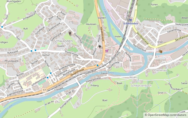
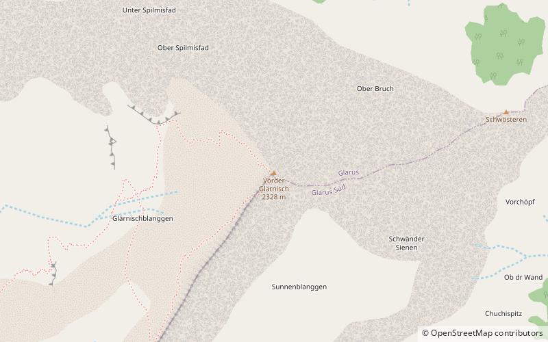
The Vorder Glärnisch is a mountain of the Schwyzer Alps, overlooking the valley of the Linth in the canton of Glarus. It lies north-east of the higher Glärnisch. ()
GlarusSwitzerland
Vorder Glärnisch – popular in the area (distance from the attraction)
Nearby attractions include: Klöntalersee, Garichtisee, Oberblegisee, Obersee.
 Nature, Natural attraction, Lake Nature, Natural attraction, Lake- Klöntalersee- 77 min walk • Nestled in the heart of the Glarus Alps, Klöntalersee is a serene and picturesque lake in Switzerland that captivates visitors with its tranquil beauty. This magnificent body of water is a natural reservoir, stretching approximately 3.3 kilometers in length... 
 Nature, Natural attraction, Lake Nature, Natural attraction, Lake- Garichtisee- 137 min walk • Garichtisee is a reservoir on Mettmenalp above Schwanden in the Canton of Glarus, Switzerland. The lake's surface area is 16 ha. 
 Nature, Natural attraction, Lake Nature, Natural attraction, Lake- Oberblegisee- 82 min walk • Oberblegisee is a lake in the Canton of Glarus, Switzerland. It is located at an elevation of 1,422 metres, above the village of Luchsingen and below the peaks of Glärnisch. Its surface area is 0.17 square kilometres. 
 Nature, Natural attraction, Lake Nature, Natural attraction, Lake- Obersee- 119 min walk • Obersee is a lake on Oberseealp in the Canton of Glarus, Switzerland. Its surface area is 24 ha. There is a hotel on the lakeside which overlooks the lake and the Brünnelistock. During a cold and dry winter, there is a chance of black ice developing. 
 Church Church- Stadtkirche Glarus, Glarus- 44 min walk • The Stadtkirche Glarus is the main Reformed church for the city of Glarus in the canton of Glarus in Switzerland. 
 Nature, Natural attraction, Mountain Nature, Natural attraction, Mountain- Rautispitz- 88 min walk • The Rautispitz is a mountain of the Schwyzer Alps, overlooking Netstal in the canton of Glarus. It lies between the Obersee and the Klöntalersee and culminates at 2,283 metres above sea level. 
 Area Area- Glarus Süd, Glarus- 63 min walk • Glarus Süd is a municipality in the Swiss canton of Glarus. It comprises the upper Linth valley, and the entire Sernf valley, and includes the villages of Betschwanden, Braunwald, Diesbach, Elm, Engi, Haslen, Hätzingen, Leuggelbach, Linthal, Luchsingen, Matt, Mitlödi, Nidfurn, Rüti, Schwanden, Schwändi and Sool. 
 Nature, Natural attraction, Mountain Nature, Natural attraction, Mountain- Glärnisch- 66 min walk • The Glärnisch is a mountain massif of the Schwyz Alps, overlooking the valley of the Linth in the Swiss canton of Glarus. It consists of several summits, of which the highest, Bächistock, is 2,915 metres above sea level. 
 Church Church- St. Hilarius Parish Church of Näfels- 141 min walk • St. Hilarius Parish Church of Näfels is a Catholic church in Näfels, Glarus Nord, Glarus Canton, Switzerland. It is listed as a Cultural Property of National Significance. 
 Nature, Natural attraction, Mountain Nature, Natural attraction, Mountain- Fronalpstock- 116 min walk • The Fronalpstock is a mountain of the Glarus Alps, located east of Glarus in the canton of Glarus. 
 Nature, Natural attraction, Mountain Nature, Natural attraction, Mountain- Zindlenspitz- 137 min walk • The Zindlenspitz is a mountain of the Schwyzer Alps, located on the border between the Swiss cantons of Schwyz and Glarus. It lies on the range between the Wägitalersee and the Obersee, south of the Brünnelistock. 
