Älplihorn
#817 among destinations in Switzerland

Facts and practical information
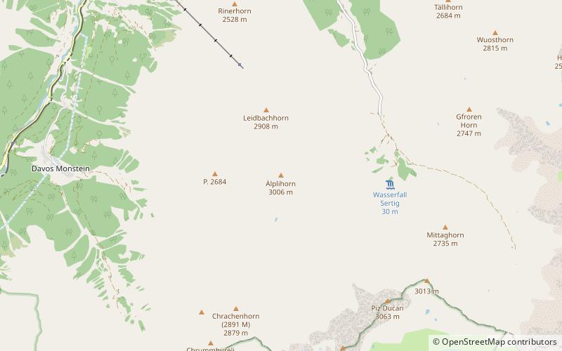
The Älplihorn is a mountain of the Albula Alps, overlooking Monstein in the canton of Graubünden, Switzerland. ()
GraubündenSwitzerland
Älplihorn plan & book
Unleash the traveler in you — discover the cheapest flight deals, find the perfect hotel or hostel nearby, and search for the best car rental prices. Travel at your own pace to discover new places and enjoy your journey.
Älplihorn – popular in the area (distance from the attraction)
Nearby attractions include: Jakobshorn, Wiesen Viaduct, Schwarzhorn, Gletscher Ducan.
 Nature, Natural attraction, Ski area
Jakobshorn, Davos
113 min walk • The Jakobshorn is a mountain of the Albula Alps, overlooking Davos in the Swiss canton of Graubünden. It is also one of the five skiing regions of the Davos Klosters Mountains, offering 14 pistes.
 Bridge
Wiesen Viaduct
139 min walk • The Wiesen Viaduct is a single-track railway viaduct, made from concrete blocks with dimension stone coverage. It spans the Landwasser southwest of the hamlet of Wiesen, in the canton of Grisons, Switzerland.
 Nature, Natural attraction, Mountain
Schwarzhorn
148 min walk • The Flüela Schwarzhorn is a mountain of the Albula Alps, overlooking the Flüela Pass, in the canton of Graubünden. With a height of 3,146 metres above sea level, it is the highest point of the Albula Alps north of the Fuorcla da Grialetsch.
 Mountain
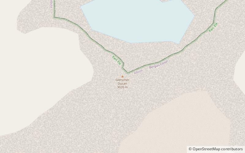
Gletscher Ducan
64 min walk • The Gletscher Ducan is a mountain of the Albula Alps, located in Graubünden, Switzerland. On its northern side lies a glacier named Ducangletscher. It lies south-west of the Hoch Ducan.
 Church
Davos Frauenkirch
108 min walk • The Reformed Church in Frauenkirch near Davos is a Protestant Reformed house of worship under the preservation order of the canton of Graubünden.
 Museum
Bahnmuseum Albula
170 min walk • The Albula Railway Museum is located at the Bergün/Bravuogn railway station of the Albula Railway of the Swiss Rhaetian Railway. The museum is in operation since 2012. The museum tells the history of the construction of the Albula Railway and shows many historical plans and artifacts.
 Nature, Natural attraction, Valley
Sertig
39 min walk • The Sertig Valley is located in the municipality of Davos, south of the town, in the Swiss canton of Graubünden. It is a lateral valley of the Landwasser valley. The small village of Sertig Dörfli is accessible by road.
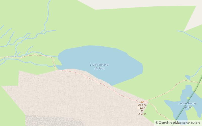 Nature, Natural attraction, Lake
Lai da Ravais-ch
74 min walk • The Lai da Ravais-ch is an Alpine lake located south of the Sertig Pass and west of the Sella da Ravais-ch, in the Swiss canton of Graubünden. The lake has an area of 0.093 km² and is located at 2,505 metres above sea level. It is located in the municipality of Bergün.
 Nature, Natural attraction, Mountain
Amselflue
150 min walk • The Amselflue is a mountain of the Plessur Alps, overlooking Arosa in the canton of Graubünden. The main summit has an elevation of 2,781 metres, while the eastern summit, located directly above the Maienfelder Furgga, is 2,768 metre high.
 Nature, Natural attraction, Valley
Dischma
127 min walk • The Dischma is a valley on the territory of the Swiss municipality of Davos. The name is derived from the Latin: decimus. It is documented as decimata in the 12th century.
 Nature, Natural attraction, Mountain
Hoch Ducan
49 min walk • The Hoch Ducan is a mountain in the Albula Range, located in Graubünden, Switzerland.


