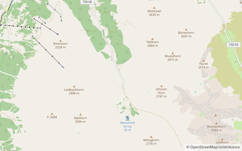
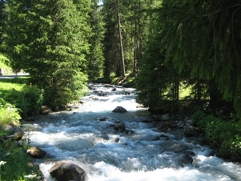
Sertig
#1110 among destinations in Switzerland


Facts and practical information
GraubündenSwitzerland
Sertig plan & book
Unleash the traveler in you — discover the cheapest flight deals, find the perfect hotel or hostel nearby, and search for the best car rental prices. Travel at your own pace to discover new places and enjoy your journey.
Sertig – popular in the area (distance from the attraction)
Nearby attractions include: Jakobshorn, Schwarzhorn, Flüela Wisshorn, Gletscher Ducan.
3.2 miN
Nature, Natural attraction, Ski areaJakobshorn, Davos
83 min walk • The Jakobshorn is a mountain of the Albula Alps, overlooking Davos in the Swiss canton of Graubünden. It is also one of the five skiing regions of the Davos Klosters Mountains, offering 14 pistes.
4.5 miE
Nature, Natural attraction, MountainSchwarzhorn
114 min walk • The Flüela Schwarzhorn is a mountain of the Albula Alps, overlooking the Flüela Pass, in the canton of Graubünden. With a height of 3,146 metres above sea level, it is the highest point of the Albula Alps north of the Fuorcla da Grialetsch.
6.1 miNE
Nature, Natural attraction, MountainFlüela Wisshorn
157 min walk • The Flüela Wisshorn is a mountain of the Silvretta Alps, overlooking the Flüela Pass in the Swiss canton of Graubünden.
3.6 miS
MountainGletscher Ducan
93 min walk • The Gletscher Ducan is a mountain of the Albula Alps, located in Graubünden, Switzerland. On its northern side lies a glacier named Ducangletscher. It lies south-west of the Hoch Ducan.
1.5 miSW
Nature, Natural attraction, MountainÄlplihorn
39 min walk • The Älplihorn is a mountain of the Albula Alps, overlooking Monstein in the canton of Graubünden, Switzerland.
3.8 miNW
ChurchDavos Frauenkirch
97 min walk • The Reformed Church in Frauenkirch near Davos is a Protestant Reformed house of worship under the preservation order of the canton of Graubünden.
5.5 miSE
Nature, Natural attraction, MountainPiz Grialetsch
141 min walk • Piz Grialetsch is a mountain of the Albula Alps, Switzerland, overlooking the Fuorcla da Grialetsch in the canton of Graubünden. It lies on the range between the Dischma and Engadin valleys, which culminates at Piz Vadret.
5.2 miN
3.3 miS
Nature, Natural attraction, LakeLai da Ravais-ch
84 min walk • The Lai da Ravais-ch is an Alpine lake located south of the Sertig Pass and west of the Sella da Ravais-ch, in the Swiss canton of Graubünden. The lake has an area of 0.093 km² and is located at 2,505 metres above sea level. It is located in the municipality of Bergün.
7.1 miNE
Nature, Natural attraction, MountainGorihorn
181 min walk • The Gorihorn is a mountain of the Silvretta Alps, located north of the Flüela Pass in the Swiss canton of Graubünden.
5.1 miE
High mountain pass closed in winterFlüela Pass, Davos
129 min walk • The Flüela Pass is a high mountain pass of the Swiss Alps in Graubünden. Traditionally considered the boundary between the Albula and Silvretta Alps, the pass crosses the watershed / drainage divide between the basins of the Rivers Rhine and Danube. The pass is overlooked by the Flüela Schwarzhorn and the Flüela Wisshorn.
