Waldisee
#1556 among destinations in Switzerland


Facts and practical information
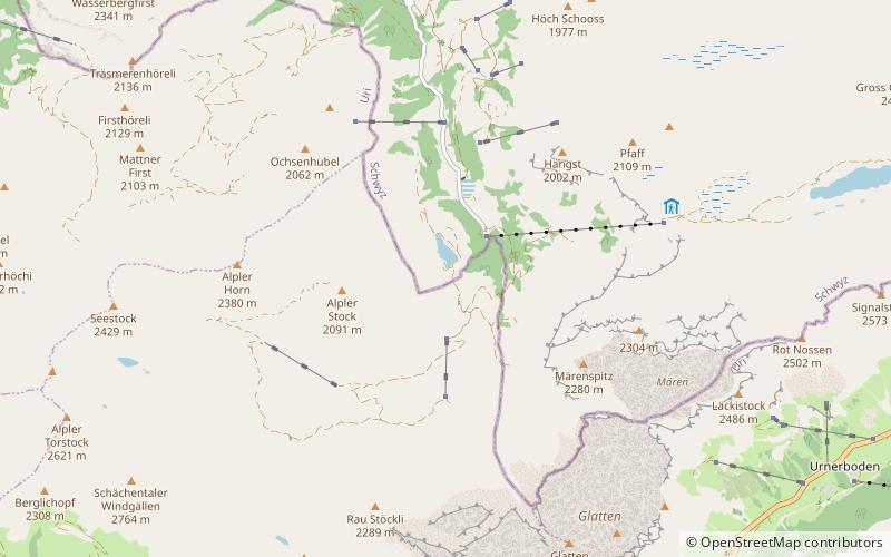
The Waldisee is a mountain lake, located south of Bisisthal, in the municipality of Muotathal, canton of Schwyz. It lies at a height of 1,406 metres, at the foot of the Alpler Stock. It has a maximum length of 420 metres. ()
UriSwitzerland
Waldisee – popular in the area (distance from the attraction)
Nearby attractions include: Hölloch, Ortstock, Clariden, Gemsfairenstock.
 Nature, Cave, Natural attraction
Hölloch
135 min walk • Delving into the depths of the Swiss Muotatal, explorers find themselves entranced by the Hölloch, one of the largest cave systems in the world. This subterranean marvel, located in the canton of Schwyz, extends more than 200 kilometers, offering an otherworldly...
 Nature, Natural attraction, Mountain
Ortstock
133 min walk • The Ortstock is a mountain in the Schwyzer Alps, located at an elevation of 2,717 m on the border between the cantons of Schwyz and Glarus. It overlooks Braunwald and Linthal on its east side, while the west side overlooks the high valley of Glattalp.
 Nature, Natural attraction, Mountain
Clariden
125 min walk • The Clariden is a mountain in the Glarus Alps, located at an elevation of 3,267 m between the Swiss cantons of Uri and Glarus. While on the north the Clariden overlooks the 1,948 m high Klausen Pass, the south side is covered by large glaciers.
 Nature, Natural attraction, Mountain
Gemsfairenstock
127 min walk • The Gemsfairenstock is a mountain of the Glarus Alps, located on the border between the Swiss cantons of Uri and Glarus. It lies east of the Klausen Pass, on the range east of the Clariden. A trail leads to its summit via the western ridge.
 Nature, Natural attraction, Mountain
Chaiserstock
139 min walk • The Chaiserstock is a mountain of the Schwyzer Alps, located on the border between the Swiss cantons of Schwyz and Uri. It lies on the range between Muotathal and Unterschächen, east of Lake Lucerne.
 Nature, Natural attraction, Mountain
Wasserbergfirst
82 min walk • The Wasserbergfirst is a mountain of the Schwyz Alps, located south of Muotathal in the canton of Schwyz. It lies on the range between the Hürital and the Bisistal, north of the Schächentaler Windgällen.
 Nature, Natural attraction, Scenic drives
Klausen Pass, Altdorf
73 min walk • Klausen Pass is a high mountain pass in the Swiss Alps connecting Altdorf in the canton of Uri with Linthal in the canton of Glarus.
 Nature, Natural attraction, Mountain
Höch Turm
122 min walk • The Höch Turm is a mountain in the Schwyzer Alps, located in an elevation of 2,666 m. It lies west of the resort village of Braunwald on the karstic range between the valleys of Muota and Linth.
 Nature, Natural attraction, Mountain
Glatten Mountain
55 min walk • The Glatten is a mountain of the Schwyzer Alps, overlooking the Klausen Pass in the canton of Uri. It is the tripoint between the valleys Bisistal, Schächental and Urner Boden. The summit consists of a large karstic plateau.
 Nature, Natural attraction, Mountain
Schächentaler Windgällen
70 min walk • The Schächentaler Windgällen is a mountain massif in the Schwyzer Alps, overlooking Unterschächen in the canton of Uri. The two named peaks are Höch Windgällen and Läged Windgällen. The mountain massif lies between the valley of Muotathal and Schächental. The Schächentaler Windgällen are located a few kilometres west of Klausen Pass.
 Nature, Natural attraction, Mountain
Pfannenstock
126 min walk • The Pfannenstock is a mountain of the Schwyzer Alps, located east of Muotathal in the Swiss canton of Schwyz. It lies on the karstic range between the valleys of Muota and Linth, west of the border with the canton of Glarus.
