Gemsfairenstock
#752 among destinations in Switzerland
Facts and practical information
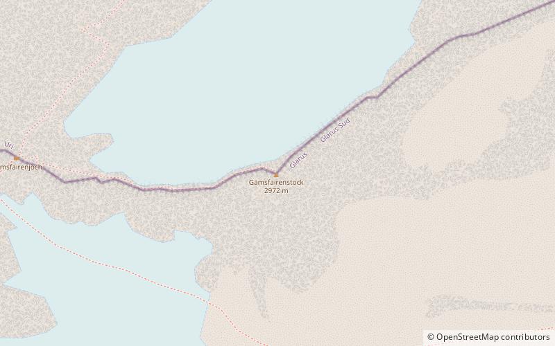
The Gemsfairenstock is a mountain of the Glarus Alps, located on the border between the Swiss cantons of Uri and Glarus. It lies east of the Klausen Pass, on the range east of the Clariden. ()
GlarusSwitzerland
Gemsfairenstock plan & book
Unleash the traveler in you — discover the cheapest flight deals, find the perfect hotel or hostel nearby, and search for the best car rental prices. Travel at your own pace to discover new places and enjoy your journey.
Gemsfairenstock – popular in the area (distance from the attraction)
Nearby attractions include: Tödi, Ortstock, Limmernsee, Clariden.
- 3.4 miSNature, Natural attraction, Mountain
Tödi
88 min walk • The Tödi, is a mountain massif and with the mountain peak Piz Russein the highest mountain in the Glarus Alps and the highest summit in the canton of Glarus, Switzerland.
- 4.7 miNNature, Natural attraction, Mountain
Ortstock
120 min walk • The Ortstock is a mountain in the Schwyzer Alps, located at an elevation of 2,717 m on the border between the cantons of Schwyz and Glarus. It overlooks Braunwald and Linthal on its east side, while the west side overlooks the high valley of Glattalp.
- 4.8 miENature, Natural attraction, Lake
Limmernsee
123 min walk • Limmernsee is a reservoir in the Canton of Glarus, Switzerland, between the peaks of Muttenchopf, Selbsanft and Kistenstöckli. It may be reached by aerial tramway or by foot from Linthal.
- 2.6 miSWNature, Natural attraction, Mountain
Clariden
66 min walk • The Clariden is a mountain in the Glarus Alps, located at an elevation of 3,267 m between the Swiss cantons of Uri and Glarus. While on the north the Clariden overlooks the 1,948 m high Klausen Pass, the south side is covered by large glaciers.
- 4.3 miSENature, Natural attraction, Mountain
Bifertenstock
111 min walk • The Bifertenstock is a mountain in the Glarus Alps, located at an elevation of 3,419 m on the border between the cantons of Glarus and Graubünden, its peak, however, is located about 25 metres south of the border.
- 4.8 miSWNature, Natural attraction, Mountain
Schärhorn
122 min walk • The Schärhorn is a mountain in the Glarus Alps near Klausen Pass. The highest summit is named Gross Schärhorn while a second summit is named Chli Schärhorn.
- 3.3 miSWHiking, Alpine hut
Planura Hut
85 min walk • The Planura Hut is a mountain hut of the Swiss Alpine Club, located on the border between the cantons of Uri and Glarus, between Amsteg and Linthal.
- 3 miWNature, Natural attraction, Scenic drives
Klausen Pass, Altdorf
76 min walk • Klausen Pass is a high mountain pass in the Swiss Alps connecting Altdorf in the canton of Uri with Linthal in the canton of Glarus.
- 4.8 miENature, Natural attraction, Mountain
Nüschenstock
123 min walk • The Nüschenstock is a mountain of the Glarus Alps, located south of Linthal in canton of Glarus. On its eastern side it overlooks the Muttsee.
- 3.1 miNWNature, Natural attraction, Mountain
Glatten Mountain
80 min walk • The Glatten is a mountain of the Schwyzer Alps, overlooking the Klausen Pass in the canton of Uri. It is the tripoint between the valleys Bisistal, Schächental and Urner Boden. The summit consists of a large karstic plateau.
- 3.4 miSENature, Natural attraction, Mountain
Selbsanft
88 min walk • The Selbsanft is a mountain massif in the Glarus Alps, overlooking the village of Linthal in the canton of Glarus. The Selbsanft is a large mountain massif consisting of several summits of which the highest is named Hideri Schibe.