Glatten Mountain
#1100 among destinations in Switzerland
![Glatten Mountain location map](https://tzmedia.b-cdn.net/media/images/static-maps/ch/46_8813_8_85934.jpg)
Facts and practical information
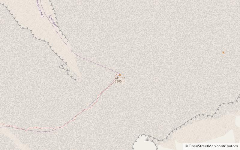
The Glatten is a mountain of the Schwyzer Alps, overlooking the Klausen Pass in the canton of Uri. It is the tripoint between the valleys Bisistal, Schächental and Urner Boden. The summit consists of a large karstic plateau. ()
Glatten Mountain plan & book
Unleash the traveler in you — discover the cheapest flight deals, find the perfect hotel or hostel nearby, and search for the best car rental prices. Travel at your own pace to discover new places and enjoy your journey.
Glatten Mountain – popular in the area (distance from the attraction)
Nearby attractions include: Tödi, Ortstock, Clariden, Gemsfairenstock.
5.5 miSENature, Natural attraction, MountainTödi
141 min walk • The Tödi, is a mountain massif and with the mountain peak Piz Russein the highest mountain in the Glarus Alps and the highest summit in the canton of Glarus, Switzerland.
5.2 miNENature, Natural attraction, MountainOrtstock
133 min walk • The Ortstock is a mountain in the Schwyzer Alps, located at an elevation of 2,717 m on the border between the cantons of Schwyz and Glarus. It overlooks Braunwald and Linthal on its east side, while the west side overlooks the high valley of Glattalp.
2.8 miSNature, Natural attraction, MountainClariden
71 min walk • The Clariden is a mountain in the Glarus Alps, located at an elevation of 3,267 m between the Swiss cantons of Uri and Glarus. While on the north the Clariden overlooks the 1,948 m high Klausen Pass, the south side is covered by large glaciers.
3.1 miSENature, Natural attraction, MountainGemsfairenstock
80 min walk • The Gemsfairenstock is a mountain of the Glarus Alps, located on the border between the Swiss cantons of Uri and Glarus. It lies east of the Klausen Pass, on the range east of the Clariden. A trail leads to its summit via the western ridge.
5.2 miNWNature, Natural attraction, MountainWasserbergfirst
133 min walk • The Wasserbergfirst is a mountain of the Schwyz Alps, located south of Muotathal in the canton of Schwyz. It lies on the range between the Hürital and the Bisistal, north of the Schächentaler Windgällen.
4 miSNature, Natural attraction, MountainSchärhorn
103 min walk • The Schärhorn is a mountain in the Glarus Alps near Klausen Pass. The highest summit is named Gross Schärhorn while a second summit is named Chli Schärhorn.
4.3 miSHiking, Alpine hutPlanura Hut
111 min walk • The Planura Hut is a mountain hut of the Swiss Alpine Club, located on the border between the cantons of Uri and Glarus, between Amsteg and Linthal.
0.8 miSNature, Natural attraction, Scenic drivesKlausen Pass, Altdorf
22 min walk • Klausen Pass is a high mountain pass in the Swiss Alps connecting Altdorf in the canton of Uri with Linthal in the canton of Glarus.
5 miNENature, Natural attraction, MountainHöch Turm
128 min walk • The Höch Turm is a mountain in the Schwyzer Alps, located in an elevation of 2,666 m. It lies west of the resort village of Braunwald on the karstic range between the valleys of Muota and Linth.
3.2 miWNature, Natural attraction, MountainSchächentaler Windgällen
83 min walk • The Schächentaler Windgällen is a mountain massif in the Schwyzer Alps, overlooking Unterschächen in the canton of Uri. The two named peaks are Höch Windgällen and Läged Windgällen. The mountain massif lies between the valley of Muotathal and Schächental. The Schächentaler Windgällen are located a few kilometres west of Klausen Pass.
4 miSNature, Natural attraction, Natural featureHüfi Glacier
103 min walk • The Hüfi Glacier is a 7 km long glacier situated in the Glarus Alps in the canton of Uri in Switzerland. In 1973 it had an area of 13.64 km2.