Piz Materdell, Sils im Engadin/Segl
#3 among attractions in Sils im Engadin/Segl
![Piz Materdell location map](https://tzmedia.b-cdn.net/media/images/static-maps/ch/46_4353_9_69129.jpg)
Facts and practical information
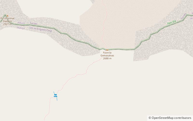
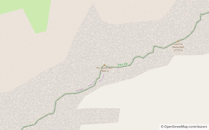
Piz Materdell is a mountain of the Albula Alps, overlooking Lake Sils in the canton of Graubünden. It lies on the range between the Septimer Pass and the Julier Pass, which culminates at Piz Lagrev. ()
Sils im Engadin/Segl Switzerland
Sils im Engadin/Segl plan & book
Unleash the traveler in you — discover the cheapest flight deals, find the perfect hotel or hostel nearby, and search for the best car rental prices. Travel at your own pace to discover new places and enjoy your journey.
Piz Materdell – popular in the area (distance from the attraction)
Nearby attractions include: Lake Sils, Lägh da Cavloc, Lägh dal Lunghin, Via Alpina.
2.3 miSENature, Natural attraction, LakeLake Sils
58 min walk • Nestled in the heart of the Swiss Alps, Lake Sils is a serene and picturesque natural wonder that captivates visitors with its crystal-clear waters and breathtaking mountainous backdrop. This stunning glacial lake, situated in the Upper Engadine valley of Switzerland...
3.9 miSNature, Natural attraction, LakeLägh da Cavloc
99 min walk • Nestled in the heart of the Swiss Alps, Lägh da Cavloc is a serene mountain lake that offers a tranquil escape from the hustle and bustle of everyday life. This alpine gem, located in the canton of Graubünden, is a pristine example of nature's beauty, with...
1.5 miSWNature, Natural attraction, LakeLägh dal Lunghin
38 min walk • Lägh dal Lunghin is a lake at an elevation of 2484 m, below the peak of Piz Lunghin, in the Graubünden, Switzerland. It is considered the source of the Inn River.
1 miEHiking trail, HikingVia Alpina
26 min walk • The Via Alpina is a network of five long-distance hiking trails across the alpine regions of Slovenia, Austria, Germany, Liechtenstein, Switzerland, Italy, France, and Monaco.
2 miSWNature, Natural attraction, MountainPiz Lunghin
51 min walk • Piz Lunghin is a mountain in the Swiss canton of Graubünden, located in the Albula range, overlooking the Maloja Pass. It is considered as the "roof of Europe" as the peak is nearby the triple watershed of the Lunghin pass.
3.1 miENature, Natural attraction, LakeLej da la Tscheppa
78 min walk • Lej da la Tscheppa is a lake above Sils Maria, in the Engadine valley of the Grisons, Switzerland. Its surface area is 7.96 ha at an elevation of 2616 m. It used to be fed by water from the Crasta-Tscheppa Glacier.
3.8 miSENatural attraction, Valley, ForestVal Fex
97 min walk • Val Fex is a southern side valley from the Upper Engadine in Switzerland, located at an altitude of around 1,800 to 2,000 metres above sea level. It belongs to the municipality of Sils im Engadin/Segl.
1.2 miSWNature, Natural attraction, MountainPiz Grevasalvas
31 min walk • Piz Grevasalvas is a mountain of the Albula Alps, located north of Maloja in the canton of Graubünden. It lies on the range between the Julier Pass and Lake Sils.
3.5 miEMuseum, Specialty museum, History museumNietzsche-Haus
90 min walk • The Nietzsche-Haus is a house in Sils Maria in the Engadin region of Switzerland, where the German philosopher Friedrich Nietzsche lived during the summers of 1881 and from 1883 to 1888.
3.1 miNEMountain passJulier Pass, Sils im Engadin/Segl
79 min walk • The Julier Pass is a mountain pass in Switzerland, in the Albula Alps. It connects the Engadin valley with central Graubünden, the nearest inhabited localities on its approaches being Silvaplana and Bivio.
3.1 miSNature, Natural attraction, LakeLägh da Bitabergh
80 min walk • Lägh da Bitabergh is a lake near Maloja Pass in Val Bregaglia, Grisons, Switzerland.