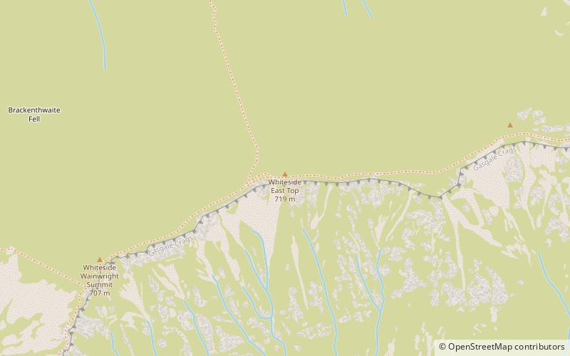
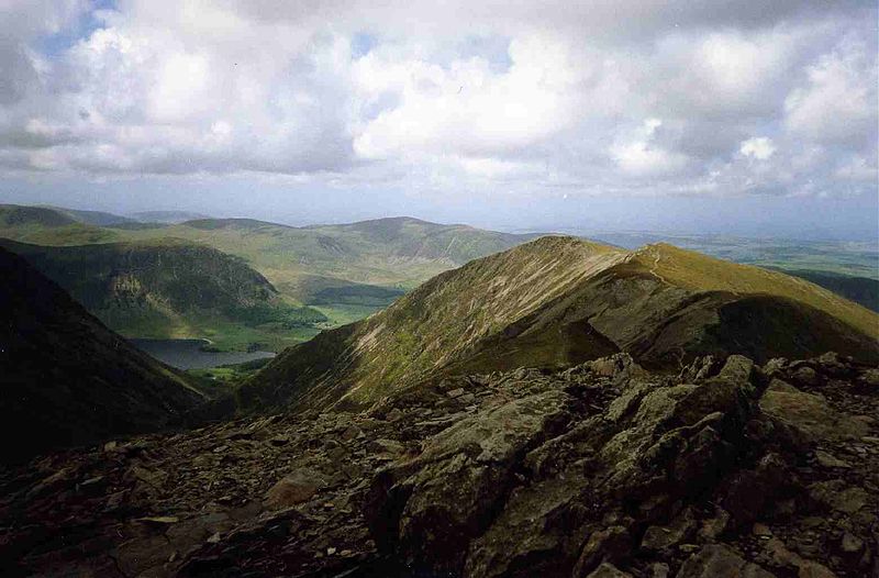
Whiteside, Lake District National Park
#55 among attractions in Lake District National Park
Facts and practical information
Whiteside is a fell in the north-western area of the English Lake District. It stands at the western end of the Grisedale Pike- Hopegill Head ridge overlooking Crummock Water. ()
Lake District National Park United Kingdom
Lake District National Park plan & book
Unleash the traveler in you — discover the cheapest flight deals, find the perfect hotel or hostel nearby, and search for the best car rental prices. Travel at your own pace to discover new places and enjoy your journey.
Whiteside – popular in the area (distance from the attraction)
Nearby attractions include: Crummock Water, Whiteless Pike, Crag Hill, Scar Crags.
- 2.2 miSWNature, Natural attraction, Lake
Crummock Water
57 min walk • Crummock Water is a lake in the Lake District in Cumbria, North West England situated between Buttermere to the south and Loweswater to the north. Crummock Water is 2.5 miles long, 0.6 miles wide and 140 feet deep. The River Cocker is considered to start at the north of the lake, before then flowing into Lorton Vale.
- 2 miSNature, Natural attraction, Cliff
Whiteless Pike
51 min walk • Whiteless Pike is a fell in the north-western English Lake District. It stands immediately east of Crummock Water and forms a pyramid shape when viewed from Rannerdale.
- 1.3 miSENature, Natural attraction, Cliff
Crag Hill
33 min walk • Crag Hill is a mountain in the North Western part of the English Lake District. It was formerly known as Eel Crag; however, the Ordnance Survey now marks Eel Crag as referring to the northern crags of the fell.
- 2.3 miENature, Natural attraction, Cliff
Scar Crags
59 min walk • Scar Crags is a fell in the north western part of the English Lake District in the county of Cumbria. It is one of the Coledale group of fells situated seven kilometres south west of Keswick and reaches a height of 672 metres.
- 2.4 miSNature, Natural attraction, Hill
Rannerdale Knotts
62 min walk • Rannerdale Knotts is a fell in the Lake District of Cumbria, England. Rising from the Buttermere valley, it is one of the smaller Cumbrian hills and is overlooked by a number of surrounding fells, such as Grasmoor, Whiteless Pike and, across Crummock Water, Mellbreak and the High Stile ridge.
- 1.5 miENature, Natural attraction, Hill
Grisedale Pike
40 min walk • Grisedale Pike is a fell in the Lake District, Cumbria, England, situated 4.5 miles west of the town of Keswick in the north-western sector of the national park.
- 0.7 miENature, Natural attraction, Hill
Hopegill Head
19 min walk • Hopegill Head is a fell in the English Lake District in Cumbria. It is located nine kilometres west of the town of Keswick and is well seen from the B5292 road which crosses the Whinlatter Pass.
- 1.1 miSNature, Natural attraction, Hill
Grasmoor
28 min walk • Grasmoor is a mountain in the north-western part of the Lake District, northern England. It is the highest peak in a group of hills between the villages of Lorton, Braithwaite and Buttermere, and overlooks Crummock Water.
- 1.9 miSENature, Natural attraction, Hill
Sail
48 min walk • Sail is a hill in the English Lake District, lying between Derwentwater and Crummock Water.
- 2.9 miENature, Natural attraction, Hill
Causey Pike
74 min walk • Causey Pike is a fell in the English Lake District. It is situated in the Newlands Valley, 5 km south-west of the town of Keswick.
- 1.3 miWHill
Brackenthwaite Hows, Cockermouth
35 min walk • Brackenthwaite Hows is a hill in the Lake District of North West England. Crummock Water, Looking Towards Buttermere, a view from the hill was painted by J. M. W. Turner in 1797.