Hutcliffe Wood, Sheffield
Map
Facts and practical information
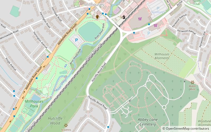
Hutcliffe Wood and Marriott Wood are two areas of ancient woodland in Sheffield, South Yorkshire, England. They occupy the steep southeastern side of the Abbeydale valley between Archer Road and Abbey Lane, separated by the River Sheaf and the railway line from Millhouses Park. Hutcliffe Wood Road divides the two areas of woodland, Hutcliffe Wood to the west and Marriott Wood to the east. ()
Coordinates: 53°20'35"N, 1°29'46"W
Address
Graves ParkSheffield
ContactAdd
Social media
Add
Getting there by public transportation
Public transportation stops near this location
- Bus
- Train
 Bus
Bus
- Calculate routeArcher Road/Aldi 4 min walk
- Calculate routeAbbeydale Road South/Hartington Avenue 5 min walk
- Calculate routeDore and Totley 34 min walk
Day trips


Frequently Asked Questions (FAQ)
Which popular attractions are close to Hutcliffe Wood?
Nearby attractions include Millhouses Park, Sheffield (7 min walk), Beauchief Abbey, Sheffield (18 min walk), Ecclesall Woods, Sheffield (19 min walk), Chesterfield Road, Sheffield (20 min walk).
How to get to Hutcliffe Wood by public transport?
The nearest stations to Hutcliffe Wood:
Bus
Train
Bus
- Archer Road/Aldi • Lines: 86 (4 min walk)
- Abbeydale Road South/Hartington Avenue • Lines: 81, 82, 97, 98, C5, C6 (5 min walk)
Train
- Dore and Totley (34 min walk)