Leeds: Area
Places and attractions in the Area category
Categories
- Church
- Park
- Museum
- Gothic Revival architecture
- Shopping
- Nightlife
- Shopping centre
- Area
- History museum
- Neighbourhood
- Golf
- Hiking trail
- Hiking
- Historical place
- Bridge
- Town
- City hall
- Music venue
- Music and shows
- Concerts and shows
- Theater
- Natural attraction
- Nature
- Specialty museum
- Georgian architecture
- Cinema
- Architecture
- Library
- Bars and clubs
- Sport venue
- Sport
- Tower
- Village
- Arenas and stadiums
Seacroft
Seacroft is an outer-city suburb/township consisting mainly of council estate housing covering an extensive area of east Leeds, West Yorkshire, England. It lies in the LS14 Leeds postcode area, around 4 miles east of Leeds city centre.
Farsley
Farsley is a town in the City of Leeds metropolitan borough, West Yorkshire, England 6 miles to the west of Leeds city centre, 4 miles east of Bradford. Farsley is situated between the two cities and near the town of Pudsey. Before April 1974, Farsley was part of the Borough of Pudsey. Before 1934 it was its own urban district council.
Swillington
Swillington is a village and civil parish near Leeds, West Yorkshire, England, in the City of Leeds metropolitan borough. It is situated 5 miles east from Leeds city centre, north of the River Aire, and is surrounded by streams including Fleakingley Beck.
Bramhope
Bramhope is a village and civil parish in the City of Leeds metropolitan borough, West Yorkshire, England, north of Holt Park and north east of Cookridge. The village is 9 miles north of Leeds city centre and it is in the LS16 Leeds postcode area. According to the 2001 census the parish had a population of 3,400.
Garforth
Garforth is a town in the metropolitan borough of the City of Leeds, West Yorkshire, England. It sits in the Garforth and Swillington ward of Leeds City Council and the Elmet and Rothwell parliamentary constituency.
Horsforth
Horsforth is a town and civil parish within the City of Leeds, in West Yorkshire, England, lying about five miles north-west of Leeds city centre. Historically a village within the West Riding of Yorkshire, it had a population of 18,895 at the 2011 Census. It became part of the City of Leeds metropolitan borough in 1974.
Pudsey
Pudsey is a market town in the City of Leeds Borough in West Yorkshire, England. It is located midway between Bradford city centre and Leeds city centre. Historically in the West Riding of Yorkshire, it has a population of 22,408.
Morley
Morley is a market town and a civil parish within the City of Leeds metropolitan borough, in West Yorkshire, England. Morley is the largest town in the Borough of Leeds after Leeds itself. Morley forms part of the Heavy Woollen District. It lies approximately 5 miles south-west of Leeds city centre.
Rothwell
Rothwell is a town in the south-east of the City of Leeds metropolitan borough in West Yorkshire, England. It is situated between Leeds and Wakefield. It is in the Rothwell ward of Leeds City Council and Elmet and Rothwell parliamentary constituency. Rothwell is part of the West Yorkshire Urban Area.
Lofthouse
Lofthouse is a village between the cities of Wakefield and Leeds in West Yorkshire, England. The village falls within the Ardsley and Robin Hood ward of the City of Leeds Council.
Guiseley
Guiseley is a town in metropolitan borough of the City of Leeds, West Yorkshire, England. Historically part of the West Riding of Yorkshire, it is situated south of Otley and Menston and is now a north-western suburb of Leeds.
St Aidan's
St Aidan's is a 400-hectare nature park located between Leeds and Castleford in West Yorkshire, England. The land was formerly an opencast coal mining area that was flooded in 1988, after the riverbank collapsed. Repairs and remediation required its own act in Parliament to allow the necessary works to go ahead.
Harehills
Harehills is an inner-city area of east Leeds, West Yorkshire, England. It is approximately 1 mile north east of Leeds city centre. Harehills is situated between the A58 and the A64.
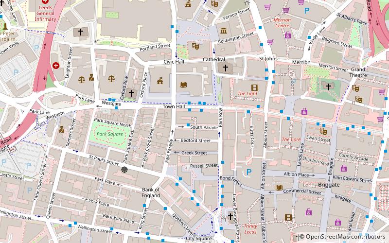
Leeds city centre
Leeds city centre is the central business district of Leeds, West Yorkshire, England. It is roughly bounded by the Inner Ring Road to the north and the River Aire to the south and can be divided into several quarters.
Beeston
Beeston is a suburb of Leeds, West Yorkshire, England located on a hill about 2 miles south of the city centre. The origins of Beeston can be traced back to the medieval period.
Map


