Maidenhead Waterways, Maidenhead

Gallery (1)
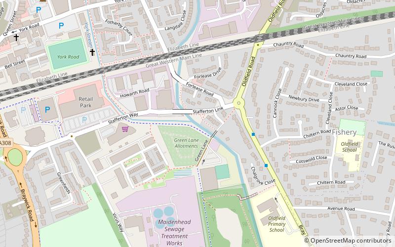
Map
Map
Facts and practical information
The Maidenhead Waterways are a system of canals in Maidenhead, England. Formerly disused, plans to restore and upgrade them were announced in 2011. The works would initially make the waterways navigable by small craft, and over time by larger craft, as limitations to navigation are gradually removed. ()
Coordinates: 51°31'5"N, 0°42'44"W
Address
Maidenhead
ContactAdd
Social media
Add
Getting there by public transportation
Public transportation stops near this location
- Bus
- Train
 Bus
Bus
- Calculate routeBridge Avenue 9 min walk
- Calculate routeRailway Bridge 10 min walk
- Calculate routeLibrary 11 min walk
- Calculate routeWaldeck Road 11 min walk
- Calculate routeMaidenhead 12 min walk
- Calculate routeFurze Platt 32 min walk
Day trips


Frequently Asked Questions (FAQ)
Which popular attractions are close to Maidenhead Waterways?
Nearby attractions include Maidenhead Heritage Centre, Maidenhead (10 min walk), Braywick Park, Maidenhead (10 min walk), Maidenhead Town Hall, Maidenhead (10 min walk), St Mary's Church, Maidenhead (12 min walk).
How to get to Maidenhead Waterways by public transport?
The nearest stations to Maidenhead Waterways:
Bus
Train
Bus
- Bridge Avenue • Lines: 15, 63 (9 min walk)
- Railway Bridge • Lines: 4 (10 min walk)
Train
- Maidenhead (12 min walk)
- Furze Platt (32 min walk)