Winchmore Hill, London
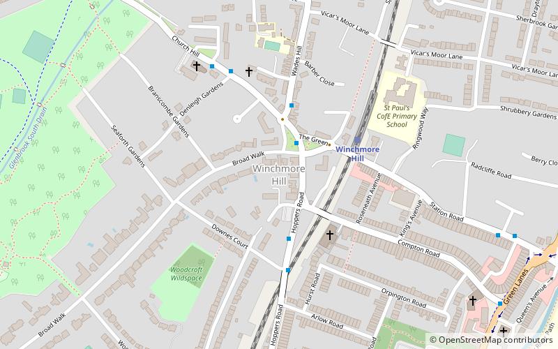
Map
Facts and practical information
Winchmore Hill is an affluent suburb and electoral ward in the Borough of Enfield, North London, in the N21 postal district. With the Winchmore Hill conservation area as a focal point, the district is bounded on the east by Green Lanes, Barrowell Green, Firs Lane and Fords Grove, and on the north-west by Grovelands Park; in the south it extends to part of Aldermans Hill, and in the north to Vicars Moor Lane and Houndsden Road. Winchmore Hill is 8.9 miles north north-east of Charing Cross. ()
Address
Enfield (Winchmore Hill)London
ContactAdd
Social media
Add
Getting there by public transportation
Public transportation stops near this location
- Metro
- Bus
- Train
 Metro
Metro
- Calculate routeHail & Ride Winchmore Hill / The Green 2 min walk
- Calculate routeWinchmore Hill Station 3 min walk
- Calculate routeWinchmore Hill 3 min walk
- Calculate routeGrange Park 19 min walk
- Calculate routePalmers Green 28 min walk
- Calculate routeSouthgate 27 min walk
Maps Tube
Tube
TubeDay trips


Frequently Asked Questions (FAQ)
Which popular attractions are close to Winchmore Hill?
Nearby attractions include Grovelands Park, London (12 min walk), Grange Park Methodist Church, London (18 min walk), Southgate Methodist Church, London (23 min walk).
How to get to Winchmore Hill by public transport?
The nearest stations to Winchmore Hill:
Bus
Train
Metro
Bus
- Hail & Ride Winchmore Hill / The Green • Lines: W9 (2 min walk)
- Winchmore Hill Station • Lines: 456 (3 min walk)
Train
- Winchmore Hill (3 min walk)
- Grange Park (19 min walk)
Metro
- Southgate • Lines: Piccadilly (27 min walk)