Taddington Moor, Peak District
#143 among attractions in Peak District
Facts and practical information
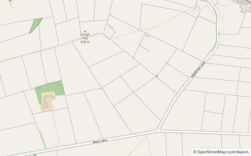
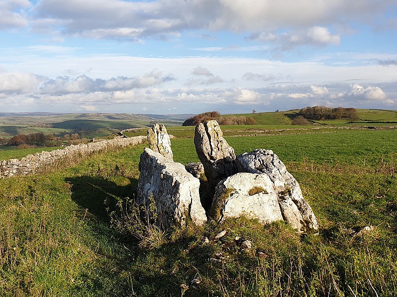
Taddington Moor is a limestone hill between the villages of Taddington, Flagg and Chelmorton in the Derbyshire Peak District. The moor is an upland farming landscape. The summit at Sough Top is 438 metres above sea level. ()
Peak District United Kingdom
Peak District plan & book
Unleash the traveler in you — discover the cheapest flight deals, find the perfect hotel or hostel nearby, and search for the best car rental prices. Travel at your own pace to discover new places and enjoy your journey.
Taddington Moor – popular in the area (distance from the attraction)
Nearby attractions include: Monsal Trail, St John the Baptist, Chee Dale, High Peak Trail.
- 2.9 miEHiking, Hiking trail
Monsal Trail, Peak District
74 min walk • The Monsal Trail is a cycling, horse riding and walking trail in the Derbyshire Peak District. It was constructed from a section of the former Manchester, Buxton, Matlock and Midland Junction Railway, which was built by the Midland Railway in 1863 to link Manchester with London and closed in 1968.
- 3.3 miNChurch
St John the Baptist, Tideswell
86 min walk • The church of St John the Baptist in Tideswell is a Church of England parish church.
- 1.6 miNWValley
Chee Dale, Peak District
43 min walk • Chee Dale is a steep-sided gorge on the River Wye near Buxton, Derbyshire, in the Peak District of England. Wye Dale continues upstream towards Buxton while downstream are Miller's Dale village and valley.
- 2.4 miSWHiking, Hiking trail
High Peak Trail
61 min walk • The High Peak Trail is a 17-mile trail for walkers, cyclists and horse riders in the Peak District of England.
- 2.8 miNEValley
Cressbrook Dale, Peak District
72 min walk • Cressbrook Dale is a dry carboniferous limestone gorge near Bakewell, Derbyshire, in the Peak District of England. The dale is cut into a plateau of farmland and lies to the south east of the village of Litton.
- 2.1 miNValley
Monk's Dale, Peak District
54 min walk • Monk's Dale is a short steep-sided dry gorge near Buxton, Derbyshire, in the Peak District of England. The dale is cut into a plateau of farmland and lies to the east of the village of Wormhill. The head of the valley leads into Peter Dale to the north. Miller's Dale is at the foot of the valley to the south.
- 3.6 miSWNature, Natural attraction, Mountain
High Wheeldon, Peak District
91 min walk • High Wheeldon is a distinctive dome-shaped hill near the Staffordshire border in Derbyshire, in the Peak District valley of Upper Dovedale, overlooking the villages of Earl Sterndale, Longnor and Crowdecote.
- 3.4 miNValley
Peter Dale, Peak District
87 min walk • Peter Dale is a short dry crag-sided valley near Buxton, Derbyshire, in the Peak District of England. There is a farmland plateau on either side.
- 2.8 miSEMemorial
Magpie Mine, Peak District
71 min walk • Magpie Mine is a well-preserved disused lead mine near the village of Sheldon in Derbyshire, England, in the parish of Ashford in the Water. The walled enclosure of five lead mines is a protected Scheduled Monument. Mid-Derbyshire has a history of industrial lead mining going back to Roman times.
- 2.9 miENature, Natural attraction, Valley
Monsal Dale, Peak District
74 min walk • Monsal Dale is a valley in Derbyshire, England, in the White Peak limestone area of the Peak District National Park. It is a Site of Special Scientific Interest, a Special Area of Conservation and part of a Europe-wide network called Natura 2000.
- 2.4 miNValley
Tideswell Dale, Peak District
63 min walk • Tideswell Dale is a short dry limestone valley near Tideswell village, Derbyshire, in the Peak District of England. There is a farmland plateau on either side.