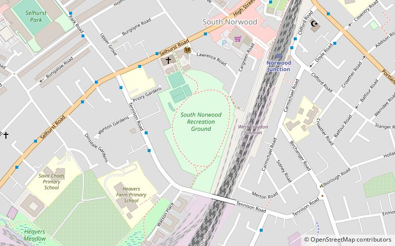
South Norwood Recreation Ground, London
Map
Facts and practical information
South Norwood Recreation Ground is a park located in South Norwood in the London Borough of Croydon. In 1889, Croydon Corporation acquired the land and the borough surveyor estimated that it would cost just over £1,300 to lay out. Over a quarter of the projected cost was to install land drainage, which indicates that the site was quite wet. The recreation ground includes a sports area, football pitches, tennis court, floodlit courts, bowling green with pavilion and a children's playground. ()
Elevation: 174 ft a.s.l.Coordinates: 51°23'43"N, 0°4'42"W
Address
Croydon (South Norwood)London
ContactAdd
Social media
Add
Getting there by public transportation
Public transportation stops near this location
- Bus
- Tram
- Train
 Bus
Bus
- Calculate routeWynton Gardens 3 min walk
- Calculate routeHeavers Farm School 3 min walk
- Calculate routeRussell Court 4 min walk
- Calculate routeSelhurst Road / Park Road 4 min walk
- Calculate routeNorwood Junction 6 min walk
- Calculate routeSelhurst 13 min walk
- Calculate routeThornton Heath 26 min walk
- Calculate routeBirkbeck 28 min walk
- Calculate routeBlackhorse Lane 21 min walk
- Calculate routeWoodside 21 min walk
- Calculate routeHarrington Road 21 min walk
- Calculate routeArena 23 min walk
Maps Tube
Tube
TubeDay trips


Frequently Asked Questions (FAQ)
Which popular attractions are close to South Norwood Recreation Ground?
Nearby attractions include Holmesdale Fanatics, London (10 min walk), Ashburton Park, Warlingham (23 min walk), South Norwood Lake and Grounds, London (23 min walk), Addiscombe Railway Park, Warlingham (23 min walk).
How to get to South Norwood Recreation Ground by public transport?
The nearest stations to South Norwood Recreation Ground:
Bus
Train
Tram
Bus
- Wynton Gardens • Lines: 410 (3 min walk)
- Heavers Farm School • Lines: 410 (3 min walk)
Train
- Norwood Junction (6 min walk)
- Selhurst (13 min walk)
Tram
- Blackhorse Lane • Lines: 2, 4 (21 min walk)
- Woodside • Lines: 2, 4 (21 min walk)